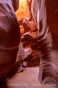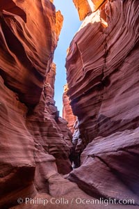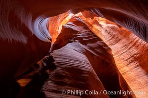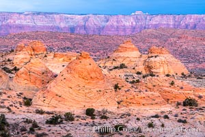
The Windows at sunset, Arches National Park.
Location: North Window, Arches National Park, Utah
Image ID: 37868
Panorama dimensions: 5203 x 16982
Location: North Window, Arches National Park, Utah
Image ID: 37868
Panorama dimensions: 5203 x 16982
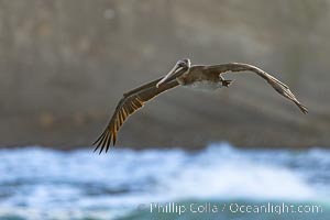
Brown Pelican Flying Along Sheer Ocean Cliffs, rare westerly winds associated with a storm allow pelicans to glide along La Jolla's cliffs as they approach shelves and outcroppings on which to land. Backlit by rising sun during stormy conditions.
Species: Brown Pelican, Pelecanus occidentalis, Pelecanus occidentalis californicus
Location: La Jolla, California
Image ID: 38868
Species: Brown Pelican, Pelecanus occidentalis, Pelecanus occidentalis californicus
Location: La Jolla, California
Image ID: 38868
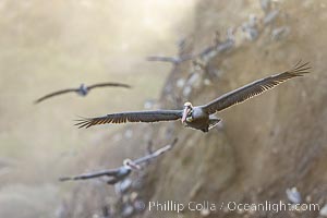
Brown Pelicans Flying Along Sheer Ocean Cliffs, rare westerly winds associated with a storm allow pelicans to glide along La Jolla's cliffs as they approach shelves and outcroppings on which to land. Backlit by rising sun during stormy conditions.
Species: Brown Pelican, Pelecanus occidentalis, Pelecanus occidentalis californicus
Location: La Jolla, California
Image ID: 38869
Species: Brown Pelican, Pelecanus occidentalis, Pelecanus occidentalis californicus
Location: La Jolla, California
Image ID: 38869
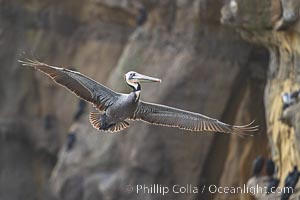
Brown Pelican Flying Along Sheer Ocean Cliffs, rare westerly winds associated with a storm allow pelicans to glide along La Jolla's cliffs as they approach shelves and outcroppings on which to land. Backlit by rising sun during stormy conditions.
Species: Brown Pelican, Pelecanus occidentalis, Pelecanus occidentalis californicus
Location: La Jolla, California
Image ID: 38872
Species: Brown Pelican, Pelecanus occidentalis, Pelecanus occidentalis californicus
Location: La Jolla, California
Image ID: 38872
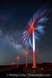
Ocotillo Wind Energy Turbines, at night with stars and the Milky Way in the sky above, the moving turbine blades illuminated by a small flashlight.
Location: Ocotillo, California
Image ID: 30239
Location: Ocotillo, California
Image ID: 30239
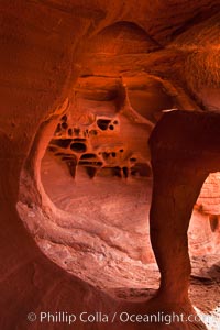
Fire Arch or Windstone Arch, also known as Fire Cave, is a tiny cave with a miniature arch and a group of natural pocket holes. Many people walk by this cave without realizing it is there!.
Location: Valley of Fire State Park, Nevada
Image ID: 26475
Location: Valley of Fire State Park, Nevada
Image ID: 26475
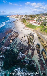
Exposed reef near Windansea, seen during King Low Tide, aerial panoramic photo.
Location: La Jolla, California
Image ID: 37972
Location: La Jolla, California
Image ID: 37972
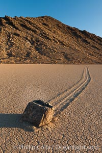
Sailing stone on the Racetrack Playa. The sliding rocks, or sailing stones, move across the mud flats of the Racetrack Playa, leaving trails behind in the mud. The explanation for their movement is not known with certainty, but many believe wind pushes the rocks over wet and perhaps icy mud in winter.
Location: Racetrack Playa, Death Valley National Park, California
Image ID: 27691
Location: Racetrack Playa, Death Valley National Park, California
Image ID: 27691
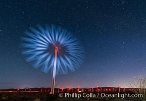
Stars rise above the Ocotillo Wind Turbine power generation facility, with a flashlight illuminating the turning turbine blades.
Image ID: 30223
Image ID: 30223
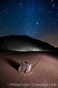
Racetrack sailing stone and Milky Way, at night. A sliding rock of the Racetrack Playa. The sliding rocks, or sailing stones, move across the mud flats of the Racetrack Playa, leaving trails behind in the mud. The explanation for their movement is not known with certainty, but many believe wind pushes the rocks over wet and perhaps icy mud in winter.
Location: Racetrack Playa, Death Valley National Park, California
Image ID: 27640
Location: Racetrack Playa, Death Valley National Park, California
Image ID: 27640
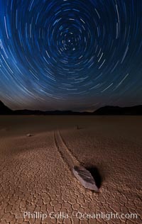
Racetrack sailing stone and star trails. A sliding rock of the Racetrack Playa. The sliding rocks, or sailing stones, move across the mud flats of the Racetrack Playa, leaving trails behind in the mud. The explanation for their movement is not known with certainty, but many believe wind pushes the rocks over wet and perhaps icy mud in winter.
Location: Racetrack Playa, Death Valley National Park, California
Image ID: 27667
Location: Racetrack Playa, Death Valley National Park, California
Image ID: 27667
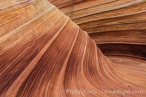
The Wave in the North Coyote Buttes, an area of fantastic eroded sandstone featuring beautiful swirls, wild colors, countless striations, and bizarre shapes set amidst the dramatic surrounding North Coyote Buttes of Arizona and Utah. The sandstone formations of the North Coyote Buttes, including the Wave, date from the Jurassic period. Managed by the Bureau of Land Management, the Wave is located in the Paria Canyon-Vermilion Cliffs Wilderness and is accessible on foot by permit only.
Location: North Coyote Buttes, Paria Canyon-Vermilion Cliffs Wilderness, Arizona
Image ID: 28602
Location: North Coyote Buttes, Paria Canyon-Vermilion Cliffs Wilderness, Arizona
Image ID: 28602
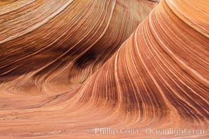
The Wave in the North Coyote Buttes, an area of fantastic eroded sandstone featuring beautiful swirls, wild colors, countless striations, and bizarre shapes set amidst the dramatic surrounding North Coyote Buttes of Arizona and Utah. The sandstone formations of the North Coyote Buttes, including the Wave, date from the Jurassic period. Managed by the Bureau of Land Management, the Wave is located in the Paria Canyon-Vermilion Cliffs Wilderness and is accessible on foot by permit only.
Location: North Coyote Buttes, Paria Canyon-Vermilion Cliffs Wilderness, Arizona
Image ID: 28603
Location: North Coyote Buttes, Paria Canyon-Vermilion Cliffs Wilderness, Arizona
Image ID: 28603
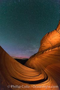
The Wave at Night, under a clear night sky full of stars. The Wave, an area of fantastic eroded sandstone featuring beautiful swirls, wild colors, countless striations, and bizarre shapes set amidst the dramatic surrounding North Coyote Buttes of Arizona and Utah. The sandstone formations of the North Coyote Buttes, including the Wave, date from the Jurassic period. Managed by the Bureau of Land Management, the Wave is located in the Paria Canyon-Vermilion Cliffs Wilderness and is accessible on foot by permit only.
Location: North Coyote Buttes, Paria Canyon-Vermilion Cliffs Wilderness, Arizona
Image ID: 28623
Location: North Coyote Buttes, Paria Canyon-Vermilion Cliffs Wilderness, Arizona
Image ID: 28623
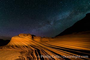
The Second Wave at Night. The Second Wave, a spectacular sandstone formation in the North Coyote Buttes, lies under a sky full of stars.
Location: North Coyote Buttes, Paria Canyon-Vermilion Cliffs Wilderness, Arizona
Image ID: 28628
Location: North Coyote Buttes, Paria Canyon-Vermilion Cliffs Wilderness, Arizona
Image ID: 28628
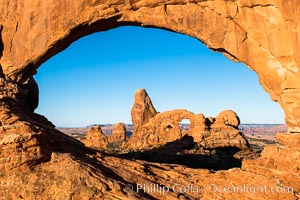
Turret Arch viewed through North Window at Sunrise.
Location: North Window, Arches National Park, Utah
Image ID: 37863
Location: North Window, Arches National Park, Utah
Image ID: 37863
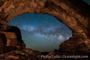
Milky Way through North Window, Arches National Park.
Location: North Window, Arches National Park, Utah
Image ID: 29277
Location: North Window, Arches National Park, Utah
Image ID: 29277
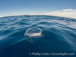
Velella, By The Wind Sailor, colonial hydroid, adrift on the ocean surface.
Species: By the wind sailor, Velella velella
Image ID: 30162
Species: By the wind sailor, Velella velella
Image ID: 30162
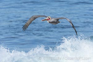
Windsurfing California Brown Pelican, La Jolla.
Species: Brown Pelican, Pelecanus occidentalis, Pelecanus occidentalis californicus
Location: La Jolla, California
Image ID: 37647
Species: Brown Pelican, Pelecanus occidentalis, Pelecanus occidentalis californicus
Location: La Jolla, California
Image ID: 37647
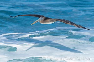
Windsurfing California Brown Pelican, La Jolla.
Species: Brown Pelican, Pelecanus occidentalis, Pelecanus occidentalis californicus
Location: La Jolla, California
Image ID: 37648
Species: Brown Pelican, Pelecanus occidentalis, Pelecanus occidentalis californicus
Location: La Jolla, California
Image ID: 37648
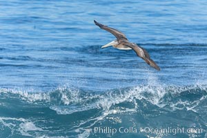
Windsurfing California Brown Pelican, La Jolla.
Species: Brown Pelican, Pelecanus occidentalis, Pelecanus occidentalis californicus
Location: La Jolla, California
Image ID: 37649
Species: Brown Pelican, Pelecanus occidentalis, Pelecanus occidentalis californicus
Location: La Jolla, California
Image ID: 37649
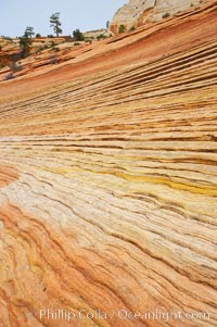
Navajo sandstone forms the cliffs and walls of Zion National Park. The sandstone reaches a thickness of 2300 feet and consists of ancient cemented desert sand dunes. Horizontal lines, commonly called crossbedding, represent layers of wind-blown sand that built up into sand dunes. These dunes were then buried, and the sand grains glued together by calcite and iron oxide to form sandstone.
Location: Zion National Park, Utah
Image ID: 12519
Location: Zion National Park, Utah
Image ID: 12519
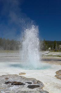
Sawmill Geyser erupting. Sawmill Geyser is a fountain-type geyser and, in some circumstances, can be erupting about one-third of the time up to heights of 35 feet. Upper Geyser Basin.
Location: Upper Geyser Basin, Yellowstone National Park, Wyoming
Image ID: 13385
Location: Upper Geyser Basin, Yellowstone National Park, Wyoming
Image ID: 13385
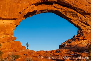
Hiker in North Window, sunset, western face. North Window is a natural sandstone arch 90 feet wide and 48 feet high.
Location: North Window, Arches National Park, Utah
Image ID: 18160
Location: North Window, Arches National Park, Utah
Image ID: 18160

Panorama of Lake Tahoe, viewed from above Incline Village. Sitting between the Carson Range to the east and the Sierra Nevada to the west, Lake Tahoe was formed about 2 to 3 million years ago and is now the second deepest lake in the United States, and tenth deepest in the world, at 1645 ft (501m) deep. It lies at an altitude of 6225 feet (1897m) above sea level. This view is from the north end of Lake Tahoe looking south.
Location: Lake Tahoe, Incline Village, Nevada
Image ID: 19128
Panorama dimensions: 3116 x 20490
Location: Lake Tahoe, Incline Village, Nevada
Image ID: 19128
Panorama dimensions: 3116 x 20490
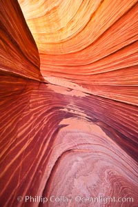
The Wave, an area of fantastic eroded sandstone featuring beautiful swirls, wild colors, countless striations, and bizarre shapes set amidst the dramatic surrounding North Coyote Buttes of Arizona and Utah. The sandstone formations of the North Coyote Buttes, including the Wave, date from the Jurassic period. Managed by the Bureau of Land Management, the Wave is located in the Paria Canyon-Vermilion Cliffs Wilderness and is accessible on foot by permit only.
Location: North Coyote Buttes, Paria Canyon-Vermilion Cliffs Wilderness, Arizona
Image ID: 20609
Location: North Coyote Buttes, Paria Canyon-Vermilion Cliffs Wilderness, Arizona
Image ID: 20609
