Search results for Wind Mill

1 2 -3- 4 5
Hedgehog hydroid cluster, Hydractinia milleri, San Miguel Island
Hedgehog hydroid cluster.
Species: Hedgehog hydroid, Hydractinia milleri
Location: San Miguel Island, California
Image ID: 01036  
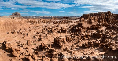
Hoodoos in Goblin Valley State Park, aerial panorama. The "goblins" are technically known as hoodoos, formed through the gradual erosion of Entrada sandstone deposited 170 millions years ago. Aerial panoramic photograph
Hoodoos in Goblin Valley State Park, aerial panorama. The "goblins" are technically known as hoodoos, formed through the gradual erosion of Entrada sandstone deposited 170 millions years ago. Aerial panoramic photograph.
Location: Goblin Valley State Park, Utah
Image ID: 37957  
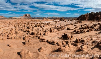
Hoodoos in Goblin Valley State Park. The "goblins" are technically known as hoodoos, formed through the gradual erosion of Entrada sandstone deposited 170 millions years ago
Hoodoos in Goblin Valley State Park. The "goblins" are technically known as hoodoos, formed through the gradual erosion of Entrada sandstone deposited 170 millions years ago.
Location: Goblin Valley State Park, Utah
Image ID: 38066  
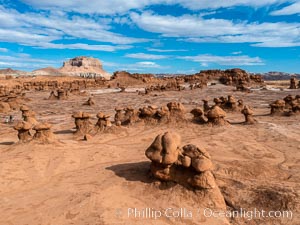
Hoodoos in Goblin Valley State Park. The "goblins" are technically known as hoodoos, formed through the gradual erosion of Entrada sandstone deposited 170 millions years ago
Hoodoos in Goblin Valley State Park. The "goblins" are technically known as hoodoos, formed through the gradual erosion of Entrada sandstone deposited 170 millions years ago.
Location: Goblin Valley State Park, Utah
Image ID: 38183  
Remarkable Rocks Panoramic Photo. It took 500 million years for rain, wind and surf to erode these rocks into their current form.  They are a signature part of Flinders Chase National Park on Kangaroo Island, South Australia
Remarkable Rocks Panoramic Photo. It took 500 million years for rain, wind and surf to erode these rocks into their current form. They are a signature part of Flinders Chase National Park on Kangaroo Island, South Australia.
Location: Flinders Chase National Park, Kangaroo Island, South Australia
Image ID: 39224  
Panorama dimensions: 200 x 674
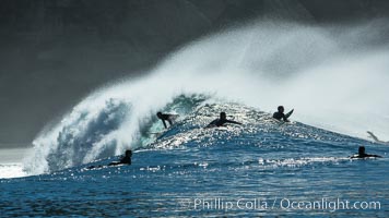
Surf and spray during Santa Ana offshore winds, San Diego, California
Surf and spray during Santa Ana offshore winds.
Location: San Diego, California
Image ID: 30462  
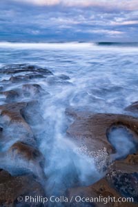
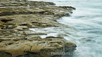
Waves wash over sandstone reef, clouds and sky, La Jolla, California
Waves wash over sandstone reef, clouds and sky.
Location: La Jolla, California
Image ID: 26335  
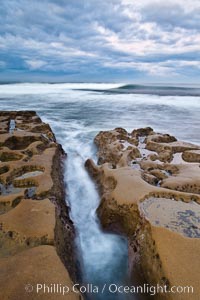
Waves wash over sandstone reef, clouds and sky, La Jolla, California
Waves wash over sandstone reef, clouds and sky.
Location: La Jolla, California
Image ID: 26336  
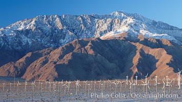
Wind turbines, rise above the flat floor of the San Gorgonio Pass near Palm Springs, with snow covered Mount San Jacinto in the background, provide electricity to Palm Springs and the Coachella Valley
Wind turbines, rise above the flat floor of the San Gorgonio Pass near Palm Springs, with snow covered Mount San Jacinto in the background, provide electricity to Palm Springs and the Coachella Valley.
Location: San Gorgonio Pass, Palm Springs, California
Image ID: 22209  
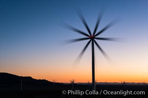
Ocotillo Express Wind Energy Projects, moving turbines lit by the rising sun,
Ocotillo Express Wind Energy Projects, moving turbines lit by the rising sun,.
Location: Ocotillo, California
Image ID: 30248  

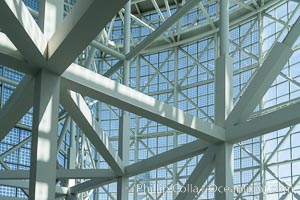
Los Angeles Convention Center, south hall, interior design exhibiting exposed space frame steel beams and glass enclosure
Los Angeles Convention Center, south hall, interior design exhibiting exposed space frame steel beams and glass enclosure.
Image ID: 29146  
Los Angeles Convention Center, south hall, interior design exhibiting exposed space frame steel beams and glass enclosure
Los Angeles Convention Center, south hall, interior design exhibiting exposed space frame steel beams and glass enclosure.
Image ID: 29151  
Surf and spray during Santa Ana offshore winds, San Diego, California
Surf and spray during Santa Ana offshore winds.
Location: San Diego, California
Image ID: 30461  
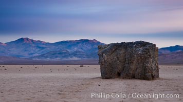
Sunrise on the Racetrack Playa. The sliding rocks, or sailing stones, move across the mud flats of the Racetrack Playa, leaving trails behind in the mud. The explanation for their movement is not known with certainty, but many believe wind pushes the rocks over wet and perhaps icy mud in winter, Death Valley National Park, California
Sunrise on the Racetrack Playa. The sliding rocks, or sailing stones, move across the mud flats of the Racetrack Playa, leaving trails behind in the mud. The explanation for their movement is not known with certainty, but many believe wind pushes the rocks over wet and perhaps icy mud in winter.
Location: Racetrack Playa, Death Valley National Park, California
Image ID: 27701  
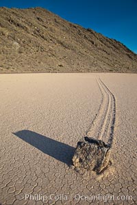
A sliding rock of the Racetrack Playa.  The sliding rocks, or sailing stones, move across the mud flats of the Racetrack Playa, leaving trails behind in the mud.  The explanation for their movement is not known with certainty, but many believe wind pushes the rocks over wet and perhaps icy mud in winter, Death Valley National Park, California
A sliding rock of the Racetrack Playa. The sliding rocks, or sailing stones, move across the mud flats of the Racetrack Playa, leaving trails behind in the mud. The explanation for their movement is not known with certainty, but many believe wind pushes the rocks over wet and perhaps icy mud in winter.
Location: Racetrack Playa, Death Valley National Park, California
Image ID: 25243  
Waves wash over sandstone reef, clouds and sky, La Jolla, California
Waves wash over sandstone reef, clouds and sky.
Location: La Jolla, California
Image ID: 26345  
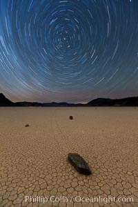
Racetrack sailing stone and star trails.  A sliding rock of the Racetrack Playa. The sliding rocks, or sailing stones, move across the mud flats of the Racetrack Playa, leaving trails behind in the mud. The explanation for their movement is not known with certainty, but many believe wind pushes the rocks over wet and perhaps icy mud in winter, Death Valley National Park, California
Racetrack sailing stone and star trails. A sliding rock of the Racetrack Playa. The sliding rocks, or sailing stones, move across the mud flats of the Racetrack Playa, leaving trails behind in the mud. The explanation for their movement is not known with certainty, but many believe wind pushes the rocks over wet and perhaps icy mud in winter.
Location: Racetrack Playa, Death Valley National Park, California
Image ID: 27668  
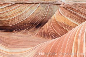
The Wave in the North Coyote Buttes, an area of fantastic eroded sandstone featuring beautiful swirls, wild colors, countless striations, and bizarre shapes set amidst the dramatic surrounding North Coyote Buttes of Arizona and Utah. The sandstone formations of the North Coyote Buttes, including the Wave, date from the Jurassic period. Managed by the Bureau of Land Management, the Wave is located in the Paria Canyon-Vermilion Cliffs Wilderness and is accessible on foot by permit only
The Wave in the North Coyote Buttes, an area of fantastic eroded sandstone featuring beautiful swirls, wild colors, countless striations, and bizarre shapes set amidst the dramatic surrounding North Coyote Buttes of Arizona and Utah. The sandstone formations of the North Coyote Buttes, including the Wave, date from the Jurassic period. Managed by the Bureau of Land Management, the Wave is located in the Paria Canyon-Vermilion Cliffs Wilderness and is accessible on foot by permit only.
Location: North Coyote Buttes, Paria Canyon-Vermilion Cliffs Wilderness, Arizona
Image ID: 28609  
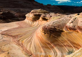
The Second Wave at sunset. The Second Wave, a curiously-shaped sandstone swirl, takes on rich warm tones and dramatic shadowed textures at sunset. Set in the North Coyote Buttes of Arizona and Utah, the Second Wave is characterized by striations revealing layers of sedimentary deposits, a visible historical record depicting eons of submarine geology, Paria Canyon-Vermilion Cliffs Wilderness
The Second Wave at sunset. The Second Wave, a curiously-shaped sandstone swirl, takes on rich warm tones and dramatic shadowed textures at sunset. Set in the North Coyote Buttes of Arizona and Utah, the Second Wave is characterized by striations revealing layers of sedimentary deposits, a visible historical record depicting eons of submarine geology.
Location: North Coyote Buttes, Paria Canyon-Vermilion Cliffs Wilderness, Arizona
Image ID: 28615  
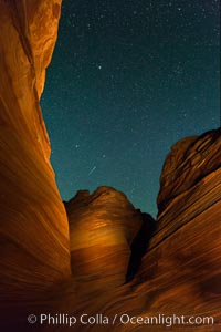
The Wave at Night, under a clear night sky full of stars.  The Wave, an area of fantastic eroded sandstone featuring beautiful swirls, wild colors, countless striations, and bizarre shapes set amidst the dramatic surrounding North Coyote Buttes of Arizona and Utah. The sandstone formations of the North Coyote Buttes, including the Wave, date from the Jurassic period. Managed by the Bureau of Land Management, the Wave is located in the Paria Canyon-Vermilion Cliffs Wilderness and is accessible on foot by permit only
The Wave at Night, under a clear night sky full of stars. The Wave, an area of fantastic eroded sandstone featuring beautiful swirls, wild colors, countless striations, and bizarre shapes set amidst the dramatic surrounding North Coyote Buttes of Arizona and Utah. The sandstone formations of the North Coyote Buttes, including the Wave, date from the Jurassic period. Managed by the Bureau of Land Management, the Wave is located in the Paria Canyon-Vermilion Cliffs Wilderness and is accessible on foot by permit only.
Location: North Coyote Buttes, Paria Canyon-Vermilion Cliffs Wilderness, Arizona
Image ID: 28624  
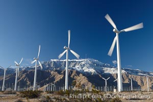
Wind turbines, rise above the flat floor of the San Gorgonio Pass near Palm Springs, with snow covered Mount San Jacinto in the background, provide electricity to Palm Springs and the Coachella Valley
Wind turbines, rise above the flat floor of the San Gorgonio Pass near Palm Springs, with snow covered Mount San Jacinto in the background, provide electricity to Palm Springs and the Coachella Valley.
Location: San Gorgonio Pass, Palm Springs, California
Image ID: 22205  
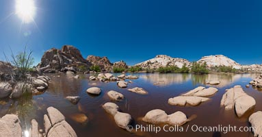
Barker Dam, Joshua Tree National Park.  Barker Dam, also known as the Big Horn Dam, is a water-storage facility located in Joshua Tree National Park in California. The dam was constructed by early cattlemen and ranchers. It is situated between Queen Valley and the Wonderland of Rocks near the Wall Street Mill and is a gathering place for desert wildlife
Barker Dam, Joshua Tree National Park. Barker Dam, also known as the Big Horn Dam, is a water-storage facility located in Joshua Tree National Park in California. The dam was constructed by early cattlemen and ranchers. It is situated between Queen Valley and the Wonderland of Rocks near the Wall Street Mill and is a gathering place for desert wildlife.
Location: Joshua Tree National Park, California
Image ID: 26731  
Panorama dimensions: 5645 x 10823
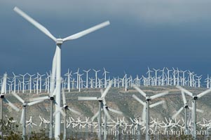
Wind turbines provide electricity to Palm Springs and the Coachella Valley. San Gorgonio pass, San Bernardino mountains, San Gorgonio Pass
Wind turbines provide electricity to Palm Springs and the Coachella Valley. San Gorgonio pass, San Bernardino mountains.
Location: San Gorgonio Pass, Palm Springs, California
Image ID: 06856  
Eglise de Knokke, 1894, Camille Pissarro, Musee d'Orsay, Paris, Musee dOrsay
Eglise de Knokke, 1894, Camille Pissarro, Musee d'Orsay, Paris.
Location: Musee dOrsay, Paris, France
Image ID: 35614  
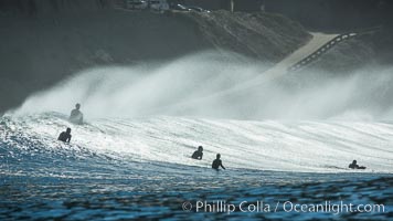
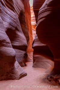
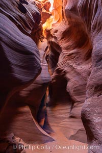
Canyon X, a spectacular slot canyon near Page, Arizona.  Slot canyons are formed when water and wind erode a cut through a (usually sandstone) mesa, producing a very narrow passage that may be as slim as a few feet and a hundred feet or more in height
Canyon X, a spectacular slot canyon near Page, Arizona. Slot canyons are formed when water and wind erode a cut through a (usually sandstone) mesa, producing a very narrow passage that may be as slim as a few feet and a hundred feet or more in height.
Location: Page, Arizona
Image ID: 36007  
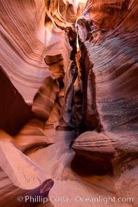
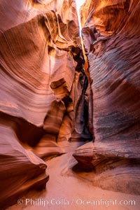
Canyon X, a spectacular slot canyon near Page, Arizona.  Slot canyons are formed when water and wind erode a cut through a (usually sandstone) mesa, producing a very narrow passage that may be as slim as a few feet and a hundred feet or more in height
Canyon X, a spectacular slot canyon near Page, Arizona. Slot canyons are formed when water and wind erode a cut through a (usually sandstone) mesa, producing a very narrow passage that may be as slim as a few feet and a hundred feet or more in height.
Location: Page, Arizona
Image ID: 36008  
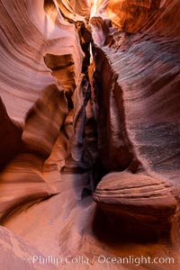
Canyon X, a spectacular slot canyon near Page, Arizona.  Slot canyons are formed when water and wind erode a cut through a (usually sandstone) mesa, producing a very narrow passage that may be as slim as a few feet and a hundred feet or more in height
Canyon X, a spectacular slot canyon near Page, Arizona. Slot canyons are formed when water and wind erode a cut through a (usually sandstone) mesa, producing a very narrow passage that may be as slim as a few feet and a hundred feet or more in height.
Location: Page, Arizona
Image ID: 36010  
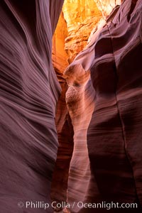
Canyon X, a spectacular slot canyon near Page, Arizona.  Slot canyons are formed when water and wind erode a cut through a (usually sandstone) mesa, producing a very narrow passage that may be as slim as a few feet and a hundred feet or more in height
Canyon X, a spectacular slot canyon near Page, Arizona. Slot canyons are formed when water and wind erode a cut through a (usually sandstone) mesa, producing a very narrow passage that may be as slim as a few feet and a hundred feet or more in height.
Location: Page, Arizona
Image ID: 36011  
Canyon X, a spectacular slot canyon near Page, Arizona.  Slot canyons are formed when water and wind erode a cut through a (usually sandstone) mesa, producing a very narrow passage that may be as slim as a few feet and a hundred feet or more in height
Canyon X, a spectacular slot canyon near Page, Arizona. Slot canyons are formed when water and wind erode a cut through a (usually sandstone) mesa, producing a very narrow passage that may be as slim as a few feet and a hundred feet or more in height.
Location: Page, Arizona
Image ID: 36012  
Canyon X, a spectacular slot canyon near Page, Arizona.  Slot canyons are formed when water and wind erode a cut through a (usually sandstone) mesa, producing a very narrow passage that may be as slim as a few feet and a hundred feet or more in height
Canyon X, a spectacular slot canyon near Page, Arizona. Slot canyons are formed when water and wind erode a cut through a (usually sandstone) mesa, producing a very narrow passage that may be as slim as a few feet and a hundred feet or more in height.
Location: Page, Arizona
Image ID: 36015  
1 2 -3- 4 5
Permalink: Wind_Mill photos

All photographs copyright © Phillip Colla / Oceanlight.com, all rights reserved worldwide.