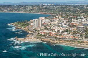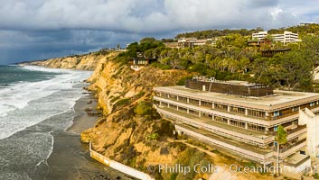
Scripps Institution of Oceanography and Blacks Beach Aerial Photo. Torrey Pines State Reserve in the distance.
Location: Scripps Institution of Oceanography, La Jolla, California
Image ID: 38039
Location: Scripps Institution of Oceanography, La Jolla, California
Image ID: 38039
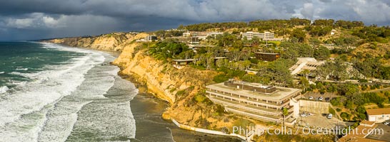
Scripps Institution of Oceanography and Blacks Beach Aerial Photo. Torrey Pines State Reserve in the distance.
Location: Scripps Institution of Oceanography, La Jolla, California
Image ID: 38040
Panorama dimensions: 2964 x 8098
Location: Scripps Institution of Oceanography, La Jolla, California
Image ID: 38040
Panorama dimensions: 2964 x 8098
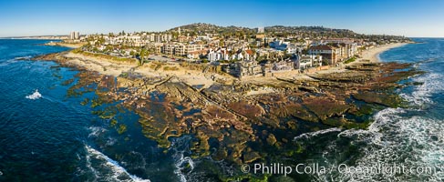
Aerial Panorama of Nicholson Point and Hospitals Beach, aerial photo, extreme low tide, La Jolla, California.
Location: La Jolla, California
Image ID: 38041
Panorama dimensions: 5143 x 12532
Location: La Jolla, California
Image ID: 38041
Panorama dimensions: 5143 x 12532
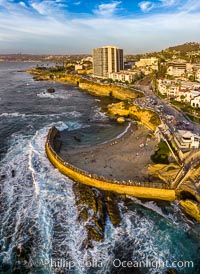
Childrens Pool seawall and Casa Cove aerial photo, La Jolla, California. Sunset. Aerial panoramic photograph.
Location: La Jolla, California
Image ID: 38072
Location: La Jolla, California
Image ID: 38072
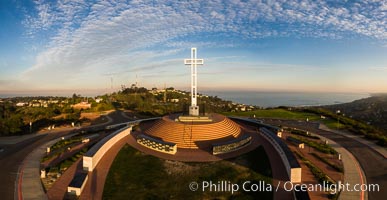
Sunrise over The Mount Soledad Cross, a landmark in La Jolla, California. The Mount Soledad Cross is a 29-foot-tall cross erected in 1954. Aerial photo.
Location: La Jolla, California
Image ID: 38125
Location: La Jolla, California
Image ID: 38125
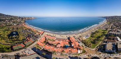
La Jolla Shores coastline, from Point La Jolla in the south to Blacks Beach in the north, aerial photo.
Location: La Jolla, California
Image ID: 38137
Location: La Jolla, California
Image ID: 38137
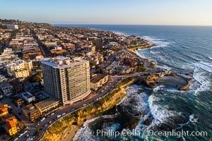
Aerial Photo of Children's Pool, Casa Cove and La Jolla Coastline.
Location: La Jolla, California
Image ID: 38145
Location: La Jolla, California
Image ID: 38145
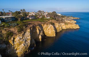
La Jolla Caves and Coastline, Goldfish Point, Aerial Photo.
Location: La Jolla, California
Image ID: 38153
Location: La Jolla, California
Image ID: 38153
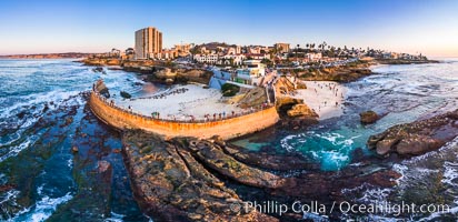
Childrens Pool Reef Exposed at Extreme Low Tide, La Jolla, California. Aerial panoramic photograph.
Location: La Jolla, California
Image ID: 38157
Panorama dimensions: 5499 x 11325
Location: La Jolla, California
Image ID: 38157
Panorama dimensions: 5499 x 11325

Torrey Pines Golf Course over looking Blacks Beach and the Pacific Ocean, south course, summer, afternoon.
Location: Torrey Pines Golf Course, San Diego, California
Image ID: 38184
Location: Torrey Pines Golf Course, San Diego, California
Image ID: 38184
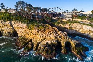
La Jolla Caves and Coastline, Goldfish Point, Aerial Photo.
Location: La Jolla, California
Image ID: 38185
Location: La Jolla, California
Image ID: 38185
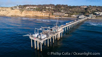
Aerial Photo of Scripps Pier. SIO Pier. The Scripps Institution of Oceanography research pier is 1090 feet long and was built of reinforced concrete in 1988, replacing the original wooden pier built in 1915. The Scripps Pier is home to a variety of sensing equipment above and below water that collects various oceanographic data. The Scripps research diving facility is located at the foot of the pier. Fresh seawater is pumped from the pier to the many tanks and facilities of SIO, including the Birch Aquarium. The Scripps Pier is named in honor of Ellen Browning Scripps, the most significant donor and benefactor of the Institution.
Location: Scripps Institution of Oceanography, La Jolla, California
Image ID: 38231
Location: Scripps Institution of Oceanography, La Jolla, California
Image ID: 38231
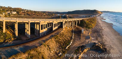
Del Mar Coastline and Bridge at sunset, aerial photo, Torrey Pines and La Jolla in the distance.
Location: Del Mar, California
Image ID: 38236
Location: Del Mar, California
Image ID: 38236
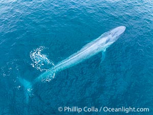
Aerial photo of blue whale near San Diego. This enormous blue whale glides at the surface of the ocean, resting and breathing before it dives to feed on subsurface krill.
Species: Blue whale, Balaenoptera musculus
Location: San Diego, California
Image ID: 39419
Species: Blue whale, Balaenoptera musculus
Location: San Diego, California
Image ID: 39419
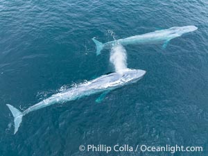
Aerial photo of two blue whales near San Diego. These enormous blue whales glide at the surface of the ocean, resting and breathing before diving to feed on subsurface krill.
Species: Blue whale, Balaenoptera musculus
Location: San Diego, California
Image ID: 39420
Species: Blue whale, Balaenoptera musculus
Location: San Diego, California
Image ID: 39420
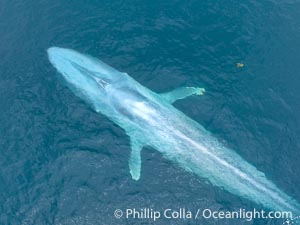
Aerial photo of blue whale near San Diego. This enormous blue whale glides at the surface of the ocean, resting and breathing before it dives to feed on subsurface krill.
Species: Blue whale, Balaenoptera musculus
Location: San Diego, California
Image ID: 39423
Species: Blue whale, Balaenoptera musculus
Location: San Diego, California
Image ID: 39423
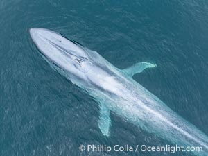
Aerial photo of blue whale near San Diego. This enormous blue whale glides at the surface of the ocean, resting and breathing before it dives to feed on subsurface krill.
Species: Blue whale, Balaenoptera musculus
Location: San Diego, California
Image ID: 39425
Species: Blue whale, Balaenoptera musculus
Location: San Diego, California
Image ID: 39425
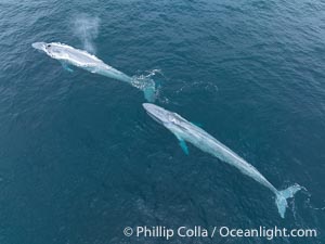
Aerial photo of two blue whales near San Diego. These enormous blue whales glide at the surface of the ocean, resting and breathing before diving to feed on subsurface krill.
Species: Blue whale, Balaenoptera musculus
Location: San Diego, California
Image ID: 39426
Species: Blue whale, Balaenoptera musculus
Location: San Diego, California
Image ID: 39426
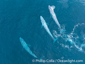
Aerial photo of three blue whales socializing near San Diego.
Species: Blue whale, Balaenoptera musculus
Location: San Diego, California
Image ID: 39430
Species: Blue whale, Balaenoptera musculus
Location: San Diego, California
Image ID: 39430
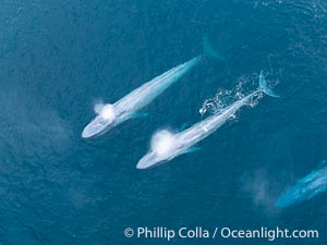
Aerial photo of two blue whales exhaling near San Diego. This enormous blue whale glides at the surface of the ocean, resting and breathing before it dives to feed on subsurface krill.
Species: Blue whale, Balaenoptera musculus
Location: San Diego, California
Image ID: 39431
Species: Blue whale, Balaenoptera musculus
Location: San Diego, California
Image ID: 39431
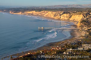
La Jolla Shores Coastline and Scripps Pier, Blacks Beach and Torrey Pines, aerial photo, sunset.
Location: La Jolla, California
Image ID: 36673
Location: La Jolla, California
Image ID: 36673
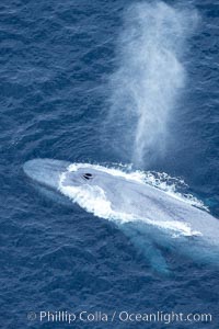
Blue whale, exhaling in a huge blow as it swims at the surface between deep dives. The blue whale's blow is a combination of water spray from around its blowhole and condensation from its warm breath.
Species: Blue whale, Balaenoptera musculus
Location: La Jolla, California
Image ID: 21258
Species: Blue whale, Balaenoptera musculus
Location: La Jolla, California
Image ID: 21258
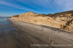
Torrey Pines balloon aerial survey photo. Torrey Pines seacliffs, rising up to 300 feet above the ocean, stretch from Del Mar to La Jolla. On the mesa atop the bluffs are found Torrey pine trees, one of the rare species of pines in the world. Peregrine falcons nest at the edge of the cliffs. This photo was made as part of an experimental balloon aerial photographic survey flight over Torrey Pines State Reserve, by permission of Torrey Pines State Reserve.
Location: Torrey Pines State Reserve, San Diego, California
Image ID: 27287
Location: Torrey Pines State Reserve, San Diego, California
Image ID: 27287
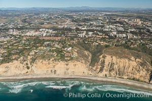
Aerial Photo of UC San Diego, Blacks Beach and La Jolla Farms.
Location: La Jolla, California
Image ID: 30709
Location: La Jolla, California
Image ID: 30709
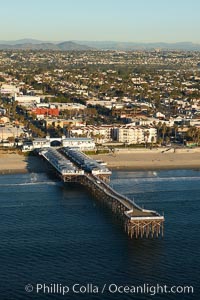
Crystal Pier, 872 feet long and built in 1925, extends out into the Pacific Ocean from the town of Pacific Beach. Mission Bay and downtown San Diego are seen in the distance.
Location: San Diego, California
Image ID: 22465
Location: San Diego, California
Image ID: 22465
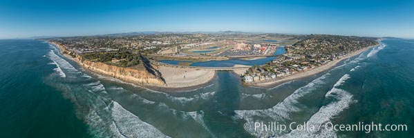
Aerial Panoramic Photo of Del Mar Dog Beach and San Dieguito River. To the left (north) is Solana Beach, to the right (south) is Del Mar with La Jolla's Mount Soledad in the distance. Beyond the San Dieguito River mouth in the center is the Del Mar Racetrack.
Location: Del Mar, California
Image ID: 30775
Panorama dimensions: 6033 x 18069
Location: Del Mar, California
Image ID: 30775
Panorama dimensions: 6033 x 18069
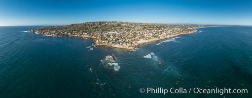
Aerial Panoramic Photo of Bird Rock and La Jolla Coast, with surfers in the waves. Pacific Beach and Mission Beach are to the far right (south). La Jolla's Mount Soledad rises in the center. The submarine reefs around Bird Rock are visible through the clear water. This extremely high resolution panorama will print 80 inches high by 200 inches wide.
Location: La Jolla, California
Image ID: 30778
Panorama dimensions: 7948 x 20303
Location: La Jolla, California
Image ID: 30778
Panorama dimensions: 7948 x 20303
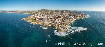
Aerial Panoramic Photo of Casa Cove, Children's Pool and La Jolla Coastline.
Location: La Jolla, California
Image ID: 30776
Panorama dimensions: 7320 x 16348
Location: La Jolla, California
Image ID: 30776
Panorama dimensions: 7320 x 16348
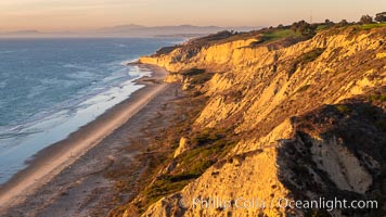
Blacks Beach and Torrey Pines sea cliffs, looking north, aerial photo, La Jolla, California.
Location: Blacks Beach, La Jolla, California
Image ID: 36555
Location: Blacks Beach, La Jolla, California
Image ID: 36555
