Sunrise on Medano Beach, on the coast of Cabo San Lucas, Mexico.
Location: Cabo San Lucas, Baja California, Mexico
Image ID: 28948
Panorama dimensions: 4368 x 16027
Location: Cabo San Lucas, Baja California, Mexico
Image ID: 28948
Panorama dimensions: 4368 x 16027

Panorama of the Teton Range reflected in the still waters of Schwabacher Landing, a sidewater of the Snake River.
Location: Grand Teton National Park, Wyoming
Image ID: 19129
Panorama dimensions: 3104 x 27272
Location: Grand Teton National Park, Wyoming
Image ID: 19129
Panorama dimensions: 3104 x 27272
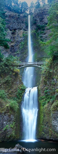
Multnomah Falls. Plummeting 620 feet from its origins on Larch Mountain, Multnomah Falls is the second highest year-round waterfall in the United States. Nearly two million visitors a year come to see this ancient waterfall making it Oregon's number one public destination.
Location: Multnomah Falls, Columbia River Gorge National Scenic Area, Oregon
Image ID: 19313
Panorama dimensions: 12453 x 4705
Location: Multnomah Falls, Columbia River Gorge National Scenic Area, Oregon
Image ID: 19313
Panorama dimensions: 12453 x 4705

Panorama of the Wave. The Wave is a sweeping, dramatic display of eroded sandstone, forged by eons of water and wind erosion, laying bare striations formed from compacted sand dunes over millenia. This panoramic picture is formed from thirteen individual photographs.
Location: North Coyote Buttes, Paria Canyon-Vermilion Cliffs Wilderness, Arizona
Image ID: 20700
Panorama dimensions: 4661 x 25458
Location: North Coyote Buttes, Paria Canyon-Vermilion Cliffs Wilderness, Arizona
Image ID: 20700
Panorama dimensions: 4661 x 25458
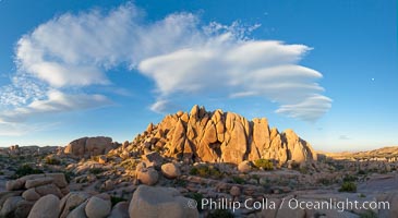
Sunset and boulders, Joshua Tree National Park. Sunset lights the giant boulders and rock formations near Jumbo Rocks in Joshua Tree N.P.
Location: Joshua Tree National Park, California
Image ID: 26719
Panorama dimensions: 5493 x 10035
Location: Joshua Tree National Park, California
Image ID: 26719
Panorama dimensions: 5493 x 10035
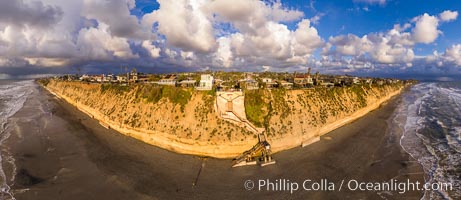
Stone Steps Beach at Sunset, Aerial Panorama, Encinitas, California.
Location: Encinitas, California
Image ID: 37945
Panorama dimensions: 6681 x 15401
Location: Encinitas, California
Image ID: 37945
Panorama dimensions: 6681 x 15401

Childrens Pool Aerial Panoramic Photo at Sunset, people enjoying the sunset on the sea wall and the protected beach, Coast Boulevard in the foreground, Mount Soledad in the distance.
Location: La Jolla, California
Image ID: 38208
Panorama dimensions: 5582 x 11191
Location: La Jolla, California
Image ID: 38208
Panorama dimensions: 5582 x 11191

Sunset over Flat Rock on Torrey Pines State Beach.
Location: Torrey Pines State Reserve, San Diego, California
Image ID: 29105
Panorama dimensions: 3831 x 12302
Location: Torrey Pines State Reserve, San Diego, California
Image ID: 29105
Panorama dimensions: 3831 x 12302
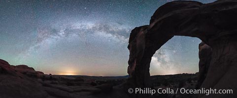
Milky Way and Stars over Broken Arch, Arches National Park, Utah.
Location: Broken Arch, Arches National Park, Utah
Image ID: 29237
Panorama dimensions: 5882 x 15117
Location: Broken Arch, Arches National Park, Utah
Image ID: 29237
Panorama dimensions: 5882 x 15117
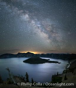
Milky Way and stars over Crater Lake at night. Panorama of Crater Lake and Wizard Island at night, Crater Lake National Park.
Location: Crater Lake National Park, Oregon
Image ID: 28643
Location: Crater Lake National Park, Oregon
Image ID: 28643

San Diego city skyline, showing the buildings of downtown San Diego rising above San Diego Harbor, viewed from Point Loma at sunset, with mountains of the Cleveland National Forest rising in the distance. A panoramic photograph, composite of six separate images. Mount San Miguel is on right and Lyons Peak to the left.
Location: San Diego, California
Image ID: 22252
Panorama dimensions: 3144 x 16621
Location: San Diego, California
Image ID: 22252
Panorama dimensions: 3144 x 16621
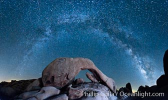
The Milky Way galaxy arcs above Arch Rock, panoramic photograph, cylindrical projection.
Location: Joshua Tree National Park, California
Image ID: 26848
Panorama dimensions: 6121 x 10275
Location: Joshua Tree National Park, California
Image ID: 26848
Panorama dimensions: 6121 x 10275
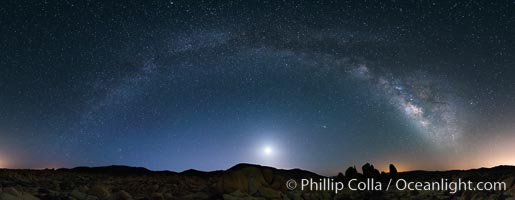
Joshua Tree National Park, Milky Way and Moon, Shooting Star, Comet Panstarrs, Impending Dawn.
Location: Joshua Tree National Park, California
Image ID: 28408
Panorama dimensions: 4205 x 10821
Location: Joshua Tree National Park, California
Image ID: 28408
Panorama dimensions: 4205 x 10821
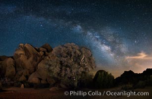
Live Oak and Milky Way, rocks and stars, Joshua Tree National Park at night.
Location: Joshua Tree National Park, California
Image ID: 28417
Panorama dimensions: 4848 x 7431
Location: Joshua Tree National Park, California
Image ID: 28417
Panorama dimensions: 4848 x 7431
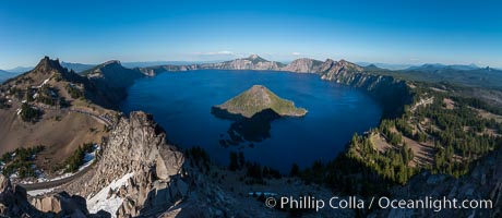
Panorama of Crater Lake from Watchman Lookout Station, panoramic picture. The Watchman Lookout Station No. 168 is one of two fire lookout towers in Crater Lake National Park in southern Oregon. For many years, National Park Service personnel used the lookout to watch for wildfires during the summer months. It is also a popular hiking destination because it offers an excellent view of Crater Lake and the surrounding area.
Location: Crater Lake National Park, Oregon
Image ID: 28633
Panorama dimensions: 4885 x 11229
Location: Crater Lake National Park, Oregon
Image ID: 28633
Panorama dimensions: 4885 x 11229

Aerial Panoramic Photo of Point La Jolla and La Jolla Cove, Boomer Beach, Scripps Park. Panoramic aerial photograph of La Jolla Cove and Scripps Parks (center), with La Jolla’s Mount Soledad rising above, La Jolla Shores and La Jolla Caves to the left and the La Jolla Coast with Children’s Pool (Casa Cove) to the right. The undersea reefs of Boomer Beach are seen through the clear, calm ocean waters. This extremely high resolution panorama will print 50″ high by 130″ long with no interpolation.
Location: La Jolla, California
Image ID: 30773
Panorama dimensions: 7744 x 20541
Location: La Jolla, California
Image ID: 30773
Panorama dimensions: 7744 x 20541

Oak Alley Plantation and its famous shaded tunnel of 300-year-old southern live oak trees (Quercus virginiana). The plantation is now designated as a National Historic Landmark.
Species: Southern live oak, Quercus virginiana
Location: Oak Alley Plantation, Vacherie, Louisiana
Image ID: 31018
Panorama dimensions: 6564 x 17803
Species: Southern live oak, Quercus virginiana
Location: Oak Alley Plantation, Vacherie, Louisiana
Image ID: 31018
Panorama dimensions: 6564 x 17803

Panorama of Bear Creek Spire over Long Lake at Sunrise, Little Lakes Valley, John Muir Wilderness, Inyo National Forest.
Location: Little Lakes Valley, Inyo National Forest, California
Image ID: 31173
Panorama dimensions: 5473 x 15812
Location: Little Lakes Valley, Inyo National Forest, California
Image ID: 31173
Panorama dimensions: 5473 x 15812

Torrey Pines cliffs.
Location: Torrey Pines State Reserve, San Diego, California
Image ID: 29133
Panorama dimensions: 4995 x 9126
Location: Torrey Pines State Reserve, San Diego, California
Image ID: 29133
Panorama dimensions: 4995 x 9126

Full Moon rising over San Diego City Skyline, viewed from Harbor Island.
Location: San Diego, California
Image ID: 29120
Panorama dimensions: 3562 x 33655
Location: San Diego, California
Image ID: 29120
Panorama dimensions: 3562 x 33655

San Diego city skyline at sunset, showing the buildings of downtown San Diego rising above San Diego Harbor, viewed from Harbor Island. A panoramic photograph, composite of four separate images.
Location: San Diego, California
Image ID: 22253
Panorama dimensions: 3415 x 14649
Location: San Diego, California
Image ID: 22253
Panorama dimensions: 3415 x 14649

Sun pillar rises over the Sierra Nevada and this Mono Lake sunset, Sierra Nevada mountain range and tufas, clouds reflected in the still waters of Mono Lake.
Location: Mono Lake, California
Image ID: 26968
Panorama dimensions: 5331 x 14966
Location: Mono Lake, California
Image ID: 26968
Panorama dimensions: 5331 x 14966
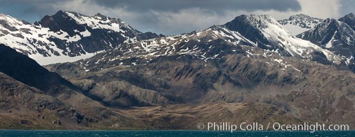
Mountains, glaciers and ocean, the rugged and beautiful topography of South Georgia Island.
Location: Grytviken, South Georgia Island
Image ID: 24580
Location: Grytviken, South Georgia Island
Image ID: 24580
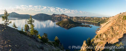
Crater Lake panoramic photograph. Panorama picture of Crater Lake National Park.
Location: Crater Lake National Park, Oregon
Image ID: 28663
Panorama dimensions: 4169 x 10222
Location: Crater Lake National Park, Oregon
Image ID: 28663
Panorama dimensions: 4169 x 10222

Self portrait, panorama of Exit Glacier. Exit Glacier, one of 35 glaciers that are spawned by the enormous Harding Icefield, is the only one that can be easily reached on foot.
Location: Exit Glacier, Kenai Fjords National Park, Alaska
Image ID: 19112
Panorama dimensions: 4298 x 17211
Location: Exit Glacier, Kenai Fjords National Park, Alaska
Image ID: 19112
Panorama dimensions: 4298 x 17211

Torrey Pines balloon aerial survey photo. Torrey Pines seacliffs, rising up to 300 feet above the ocean, stretch from Del Mar to La Jolla. On the mesa atop the bluffs are found Torrey pine trees, one of the rare species of pines in the world. Peregrine falcons nest at the edge of the cliffs. This photo was made as part of an experimental balloon aerial photographic survey flight over Torrey Pines State Reserve, by permission of Torrey Pines State Reserve.
Location: Torrey Pines State Reserve, San Diego, California
Image ID: 27271
Panorama dimensions: 5001 x 11896
Location: Torrey Pines State Reserve, San Diego, California
Image ID: 27271
Panorama dimensions: 5001 x 11896

Aerial Panorama of La Jolla, University City, showing (from left) University of California at San Diego, University City, Scripps Institution of Oceanography, La Jolla Shores, Point La Jolla, Mount Soledad, in the background some of the mountains to the east of San Diego. The highest peak in the center of the panoram is Cuyamaca Peak (6512') while the rocky peak directly in front of it is El Cajon Mountain (3675').
Image ID: 29098
Panorama dimensions: 3881 x 20864
Image ID: 29098
Panorama dimensions: 3881 x 20864
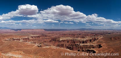
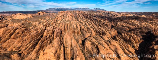
Canyonlands National Park panorama.
Location: Canyonlands National Park, Utah
Image ID: 27817
Panorama dimensions: 5316 x 11049
Location: Canyonlands National Park, Utah
Image ID: 27817
Panorama dimensions: 5316 x 11049
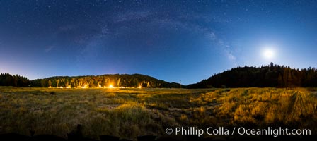
Moon and Milky Way over Palomar Mountain State Park.
Location: Palomar Mountain State Park, California
Image ID: 28748
Panorama dimensions: 4486 x 14422
Location: Palomar Mountain State Park, California
Image ID: 28748
Panorama dimensions: 4486 x 14422
