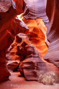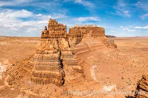
Molly's Castle, aerial view, Goblin Valley State Park.
Location: Mollys Castle, Goblin Valley State Park, Utah
Image ID: 38016
Location: Mollys Castle, Goblin Valley State Park, Utah
Image ID: 38016
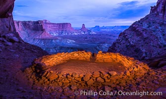
False Kiva at Sunset, Canyonlands National Park, Utah.
Location: False Kiva, Canyonlands National Park, Utah
Image ID: 28017
Location: False Kiva, Canyonlands National Park, Utah
Image ID: 28017
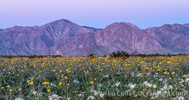
Wildflowers bloom in Anza Borrego Desert State Park, during the 2017 Superbloom.
Location: Anza-Borrego Desert State Park, Borrego Springs, California
Image ID: 33154
Location: Anza-Borrego Desert State Park, Borrego Springs, California
Image ID: 33154
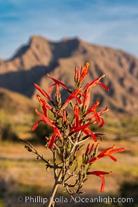
Wildflowers bloom in Anza Borrego Desert State Park, during the 2017 Superbloom.
Location: Anza-Borrego Desert State Park, Borrego Springs, California
Image ID: 33179
Location: Anza-Borrego Desert State Park, Borrego Springs, California
Image ID: 33179
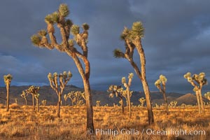
Sunrise in Joshua Tree National Park.
Species: Joshua tree, Yucca brevifolia
Location: Joshua Tree National Park, California
Image ID: 22101
Species: Joshua tree, Yucca brevifolia
Location: Joshua Tree National Park, California
Image ID: 22101
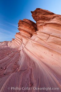
The Great Wall, Navajo Tribal Lands, Arizona. Sandstone "fins", eroded striations that depict how sandstone -- ancient compressed sand -- was laid down in layers over time. Now exposed, the layer erode at different rates, forming delicate "fins" that stretch for long distances.
Location: Navajo Tribal Lands, Page, Arizona
Image ID: 26643
Location: Navajo Tribal Lands, Page, Arizona
Image ID: 26643
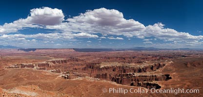
Canyonlands National Park panorama.
Location: Canyonlands National Park, Utah
Image ID: 27817
Panorama dimensions: 5316 x 11049
Location: Canyonlands National Park, Utah
Image ID: 27817
Panorama dimensions: 5316 x 11049
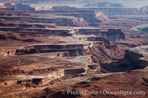
Soda Springs Basin from Green River Overlook, Island in the Sky, Canyonlands National Park, Utah.
Location: Canyonlands National Park, Utah
Image ID: 27841
Location: Canyonlands National Park, Utah
Image ID: 27841
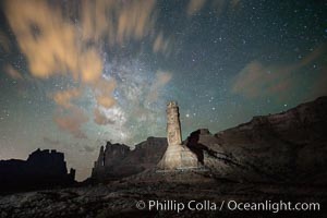
Stone columns rising in the night sky, milky way and stars and clouds filling the night sky overhead.
Location: Arches National Park, Utah
Image ID: 27848
Location: Arches National Park, Utah
Image ID: 27848
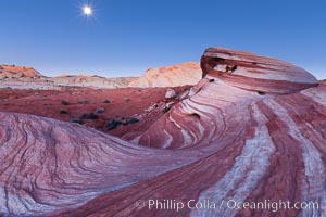
The moon sets over the Fire Wave, a beautiful sandstone formation exhibiting dramatic striations, striped layers in the geologic historical record.
Location: Valley of Fire State Park, Nevada
Image ID: 26511
Location: Valley of Fire State Park, Nevada
Image ID: 26511
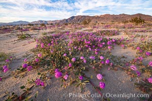
Sand verbena wildflowers on sand dunes, Anza-Borrego Desert State Park.
Species: Sand verbena, Abronia villosa
Location: Anza-Borrego Desert State Park, Borrego Springs, California
Image ID: 35114
Species: Sand verbena, Abronia villosa
Location: Anza-Borrego Desert State Park, Borrego Springs, California
Image ID: 35114
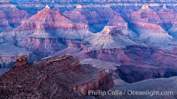
Grand Canyon at dusk, sunset, viewed from Grandeur Point on the south rim of Grand Canyon National Park.
Location: Grand Canyon National Park, Arizona
Image ID: 37753
Location: Grand Canyon National Park, Arizona
Image ID: 37753
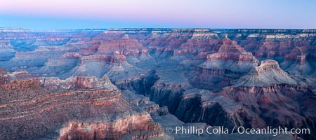
Grand Canyon at sunrise viewed from Yavapai Point on the south rim of Grand Canyon National Park.
Location: Grand Canyon National Park, Arizona
Image ID: 37757
Panorama dimensions: 5136 x 11568
Location: Grand Canyon National Park, Arizona
Image ID: 37757
Panorama dimensions: 5136 x 11568
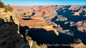
Grand Canyon at sunrise viewed from Yavapai Point on the south rim of Grand Canyon National Park.
Location: Grand Canyon National Park, Arizona
Image ID: 37760
Location: Grand Canyon National Park, Arizona
Image ID: 37760
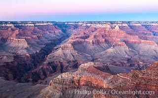
Belt of Venus over Grand Canyon at dusk, sunset, viewed from Mather Point on the south rim of Grand Canyon National Park. The Belt of Venus, or anti-twilight arch, is the shadow of the earth cast upon the atmosphere just above the horizon, and occurs a few minutes before sunrise or after sunset.
Location: Grand Canyon National Park, Arizona
Image ID: 37761
Location: Grand Canyon National Park, Arizona
Image ID: 37761
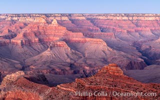
Grand Canyon at dusk, sunset, viewed from Mather Point on the south rim of Grand Canyon National Park.
Location: Grand Canyon National Park, Arizona
Image ID: 37762
Location: Grand Canyon National Park, Arizona
Image ID: 37762
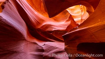
Lower Antelope Canyon, a deep, narrow and spectacular slot canyon lying on Navajo Tribal lands near Page, Arizona.
Location: Navajo Tribal Lands, Page, Arizona
Image ID: 37768
Location: Navajo Tribal Lands, Page, Arizona
Image ID: 37768
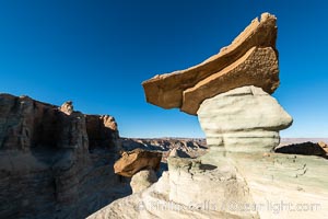
Pedestal rock, or hoodoo, at Stud Horse Point. These hoodoos form when erosion occurs around but not underneath a more resistant caprock that sits atop of the hoodoo spire. Stud Horse Point is a spectacular viewpoint on a mesa overlooking the Arizona / Utah border.
Location: Page, Arizona
Image ID: 37778
Location: Page, Arizona
Image ID: 37778
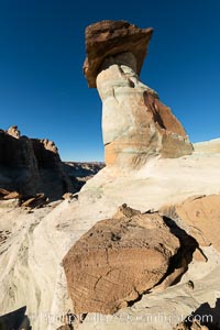
Pedestal rock, or hoodoo, at Stud Horse Point. These hoodoos form when erosion occurs around but not underneath a more resistant caprock that sits atop of the hoodoo spire. Stud Horse Point is a spectacular viewpoint on a mesa overlooking the Arizona / Utah border.
Location: Page, Arizona
Image ID: 37780
Location: Page, Arizona
Image ID: 37780
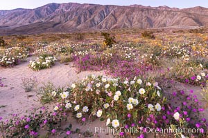
Dune primrose (white) and sand verbena (purple) bloom in spring in Anza Borrego Desert State Park, mixing in a rich display of desert color.
Species: Dune evening primrose, Sand verbena, Abronia villosa, Oenothera deltoides
Location: Anza-Borrego Desert State Park, Borrego Springs, California
Image ID: 35198
Species: Dune evening primrose, Sand verbena, Abronia villosa, Oenothera deltoides
Location: Anza-Borrego Desert State Park, Borrego Springs, California
Image ID: 35198
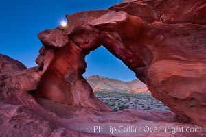
Natural arch formed in sandstone frames the setting moon.
Location: Valley of Fire State Park, Nevada
Image ID: 26486
Location: Valley of Fire State Park, Nevada
Image ID: 26486
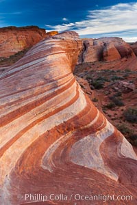
The Fire Wave, a beautiful sandstone formation exhibiting dramatic striations, striped layers in the geologic historical record.
Location: Valley of Fire State Park, Nevada
Image ID: 26487
Location: Valley of Fire State Park, Nevada
Image ID: 26487
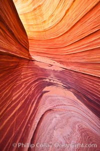
The Wave, an area of fantastic eroded sandstone featuring beautiful swirls, wild colors, countless striations, and bizarre shapes set amidst the dramatic surrounding North Coyote Buttes of Arizona and Utah. The sandstone formations of the North Coyote Buttes, including the Wave, date from the Jurassic period. Managed by the Bureau of Land Management, the Wave is located in the Paria Canyon-Vermilion Cliffs Wilderness and is accessible on foot by permit only.
Location: North Coyote Buttes, Paria Canyon-Vermilion Cliffs Wilderness, Arizona
Image ID: 20609
Location: North Coyote Buttes, Paria Canyon-Vermilion Cliffs Wilderness, Arizona
Image ID: 20609
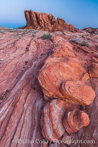
Sunrise lights sandstone rocks, Valley of Fire.
Location: Valley of Fire State Park, Nevada
Image ID: 28444
Location: Valley of Fire State Park, Nevada
Image ID: 28444
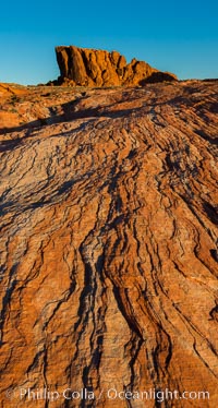
Sunrise lights sandstone rocks, Valley of Fire.
Location: Valley of Fire State Park, Nevada
Image ID: 28446
Location: Valley of Fire State Park, Nevada
Image ID: 28446
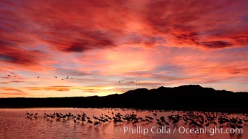
Sunset at Bosque del Apache National Wildlife Refuge, with sandhill cranes silhouetted in reflection in the calm pond. Spectacular sunsets at Bosque del Apache, rich in reds, oranges, yellows and purples, make for striking reflections of the thousands of cranes and geese found in the refuge each winter.
Species: Sandhill crane, Grus canadensis
Location: Bosque del Apache National Wildlife Refuge, Socorro, New Mexico
Image ID: 21804
Species: Sandhill crane, Grus canadensis
Location: Bosque del Apache National Wildlife Refuge, Socorro, New Mexico
Image ID: 21804
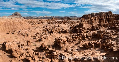
Hoodoos in Goblin Valley State Park, aerial panorama. The "goblins" are technically known as hoodoos, formed through the gradual erosion of Entrada sandstone deposited 170 millions years ago. Aerial panoramic photograph.
Location: Goblin Valley State Park, Utah
Image ID: 37957
Location: Goblin Valley State Park, Utah
Image ID: 37957
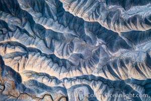
Erosion patterns in the Utah Badlands, aerial abstract photo.
Location: Hanksville, Utah
Image ID: 38017
Location: Hanksville, Utah
Image ID: 38017
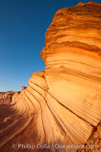
The Great Wall, Navajo Tribal Lands, Arizona. Sandstone "fins", eroded striations that depict how sandstone -- ancient compressed sand -- was laid down in layers over time. Now exposed, the layer erode at different rates, forming delicate "fins" that stretch for long distances.
Location: Navajo Tribal Lands, Page, Arizona
Image ID: 26644
Location: Navajo Tribal Lands, Page, Arizona
Image ID: 26644
