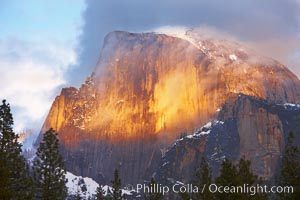
Half Dome and storm clouds at sunset, viewed from Sentinel Bridge.
Location: Half Dome, Yosemite National Park, California
Image ID: 22744
Location: Half Dome, Yosemite National Park, California
Image ID: 22744
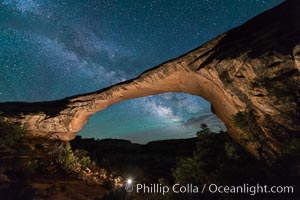
Owachomo Bridge and Milky Way. Owachomo Bridge, a natural stone bridge standing 106' high and spanning 130' wide,stretches across a canyon with the Milky Way crossing the night sky.
Location: Owachomo Bridge, Natural Bridges National Monument, Utah
Image ID: 28541
Location: Owachomo Bridge, Natural Bridges National Monument, Utah
Image ID: 28541
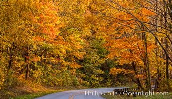
Blue Ridge Parkway Fall Colors, Asheville, North Carolina.
Location: Asheville, North Carolina
Image ID: 34635
Location: Asheville, North Carolina
Image ID: 34635
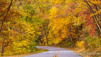
Blue Ridge Parkway Fall Colors, Asheville, North Carolina.
Location: Asheville, North Carolina
Image ID: 34638
Location: Asheville, North Carolina
Image ID: 34638
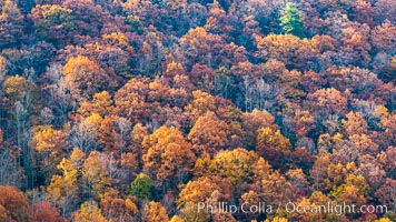
Blue Ridge Parkway Fall Colors, Asheville, North Carolina.
Location: Asheville, North Carolina
Image ID: 34640
Location: Asheville, North Carolina
Image ID: 34640
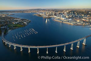
San Diego Coronado Bridge, known locally as the Coronado Bridge, links San Diego with Coronado, California. The bridge was completed in 1969 and was a toll bridge until 2002. It is 2.1 miles long and reaches a height of 200 feet above San Diego Bay. Coronado Island is to the left, and downtown San Diego is to the right in this view looking north.
Location: San Diego, California
Image ID: 22288
Location: San Diego, California
Image ID: 22288
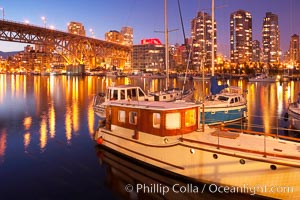
Yaletown section of Vancouver at night, including Granville Island bridge (left), viewed from Granville Island with sailboat in the foreground.
Location: Granville Island, Vancouver, British Columbia, Canada
Image ID: 21169
Location: Granville Island, Vancouver, British Columbia, Canada
Image ID: 21169
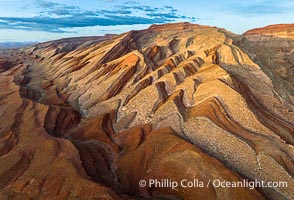
Aerial Photo of Raplee Ridge near Mexican Hat, Utah. Raplee Ridge is a spectacular series of multicolored triangular flatirons near the San Juan River. Often called "the Raplee Anticline" the geologic structure is in fact better described as a monocline, according to the Utah Geological Survey.
Location: Mexican Hat, Utah
Image ID: 39489
Location: Mexican Hat, Utah
Image ID: 39489
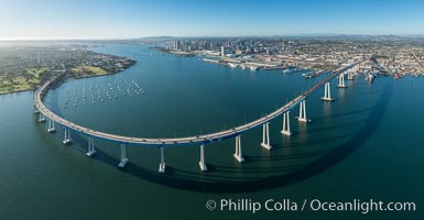
Panoramic Aerial Photo of San Diego Coronado Bay Bridge.
Location: San Diego, California
Image ID: 30789
Panorama dimensions: 7503 x 14441
Location: San Diego, California
Image ID: 30789
Panorama dimensions: 7503 x 14441
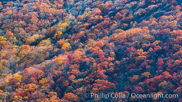
Blue Ridge Parkway Fall Colors, Asheville, North Carolina.
Location: Asheville, North Carolina
Image ID: 34636
Location: Asheville, North Carolina
Image ID: 34636
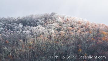
Early Snow and Late Blue Ridge Parkway Fall Colors, Asheville, North Carolina.
Location: Asheville, North Carolina
Image ID: 34637
Location: Asheville, North Carolina
Image ID: 34637
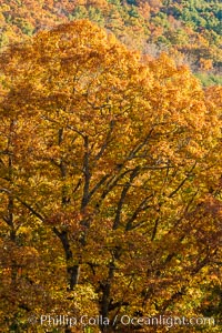
Blue Ridge Parkway Fall Colors, Asheville, North Carolina.
Location: Asheville, North Carolina
Image ID: 34641
Location: Asheville, North Carolina
Image ID: 34641
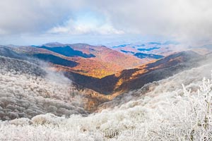
Early Snow and Late Blue Ridge Parkway Fall Colors, Asheville, North Carolina.
Location: Asheville, North Carolina
Image ID: 34642
Location: Asheville, North Carolina
Image ID: 34642
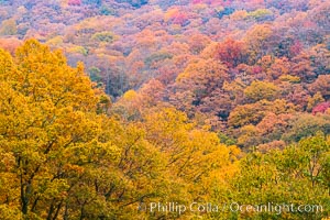
Blue Ridge Parkway Fall Colors, Asheville, North Carolina.
Location: Asheville, North Carolina
Image ID: 34643
Location: Asheville, North Carolina
Image ID: 34643
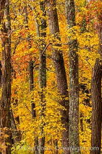
Blue Ridge Parkway Fall Colors, Asheville, North Carolina.
Location: Asheville, North Carolina
Image ID: 34644
Location: Asheville, North Carolina
Image ID: 34644
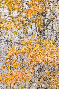
Early Snow and Late Blue Ridge Parkway Fall Colors, Asheville, North Carolina.
Location: Asheville, North Carolina
Image ID: 34647
Location: Asheville, North Carolina
Image ID: 34647
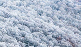
Early Snow and Late Blue Ridge Parkway Fall Colors, Asheville, North Carolina.
Location: Asheville, North Carolina
Image ID: 34648
Location: Asheville, North Carolina
Image ID: 34648
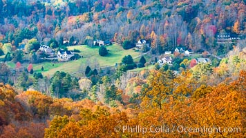
Blue Ridge Parkway Fall Colors, Asheville, North Carolina.
Location: Asheville, North Carolina
Image ID: 34649
Location: Asheville, North Carolina
Image ID: 34649
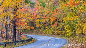
Blue Ridge Parkway Fall Colors, Asheville, North Carolina.
Location: Asheville, North Carolina
Image ID: 34650
Location: Asheville, North Carolina
Image ID: 34650
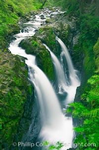
Sol Duc Falls. Sol Duc Falls is one of the largest and most beautiful waterfalls in Olympic National Park, seen here from a bridge that crosses the canyon just below the falls. Surrounding the falls is an old-growth forest of hemlocks and douglas firs, some of which are three hundred years in age.
Location: Sol Duc Springs, Olympic National Park, Washington
Image ID: 13747
Location: Sol Duc Springs, Olympic National Park, Washington
Image ID: 13747
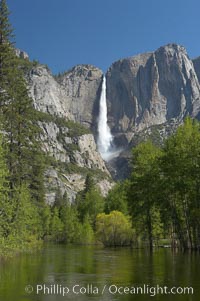
Yosemite Falls rises above the Merced River, viewed from the Swinging Bridge. The 2425 falls is the tallest in North America. Yosemite Valley.
Location: Yosemite Falls, Yosemite National Park, California
Image ID: 16143
Location: Yosemite Falls, Yosemite National Park, California
Image ID: 16143
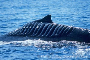
North Pacific humpback whale showing extensive scarring, almost certainly from a boat propeller, on dorsal ridge. This female North Pacific humpback whale was first seen with the depicted lacerations near the island of Maui in the Hawaiian Islands in the mid-90s, and is the original humpback to bear the name 'Blade Runner'. This female has apparently recovered, as evidenced the calf she was observed nurturing. A South Pacific humpback whale endured a similar injury in Sydney Australia in 2001, and bears a remarkably similar scar pattern to the above-pictured whale.
Species: Humpback whale, Megaptera novaeangliae
Location: Maui, Hawaii
Image ID: 05909
Species: Humpback whale, Megaptera novaeangliae
Location: Maui, Hawaii
Image ID: 05909
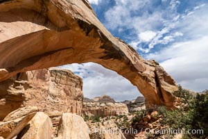
Hickman Bridge, Capitol Reef National Park.
Location: Capitol Reef National Park, Utah
Image ID: 37011
Location: Capitol Reef National Park, Utah
Image ID: 37011
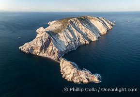
Isla San Pedro Martir at sunset with extensive forest of Cardon Cactus seen on the summit ridge of the island, aerial photo, Sea of Cortez, Mexico. San Pedro Martir Island and its marine life are, since 2002, part of the San Pedro Martir Biosphere Reserve, and is regarded as a natural laboratory of adaptive evolution, similar to that of the Galapagos Islands. It is home to 292 species of fauna and flora (both land-based and aquatic), with 42 species protected by Mexican law, and 30 listed on the Red List of Threatened Species. San Pedro Martir is also unique in the area for its year-round quantity of birds. The island is the only island in the area with a perpetually swirling cloud of sea birds. This is because the water around the island, has some of the most successful marine productivity in the world.
Location: Isla San Pedro Martir, Sonora, Mexico
Image ID: 40397
Location: Isla San Pedro Martir, Sonora, Mexico
Image ID: 40397
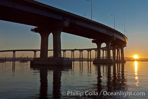
Coronado Bridge, linking San Diego to Coronado, sunrise, viewed from Coronado Island. San Diego Coronado Bridge, known locally as the Coronado Bridge, links San Diego with Coronado, California. The bridge was completed in 1969 and was a toll bridge until 2002. It is 2.1 miles long and reaches a height of 200 feet above San Diego Bay.
Location: San Diego, California
Image ID: 27101
Location: San Diego, California
Image ID: 27101
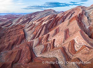
Aerial Photo of Raplee Ridge near Mexican Hat, Utah. Raplee Ridge is a spectacular series of multicolored triangular flatirons near the San Juan River. Often called "the Raplee Anticline" the geologic structure is in fact better described as a monocline, according to the Utah Geological Survey.
Location: Mexican Hat, Utah
Image ID: 39490
Location: Mexican Hat, Utah
Image ID: 39490
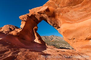
Arch Rock at sunrise, Valley of Fire State Park. Natural arch formed in sandstone. Sunrise with the full moon setting over mountains in the distance.
Location: Valley of Fire State Park, Nevada
Image ID: 26472
Location: Valley of Fire State Park, Nevada
Image ID: 26472
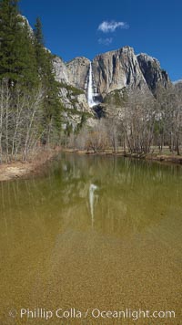
Yosemite Falls rises above the Merced River, viewed from Swinging Bridge.
Location: Yosemite Falls, Yosemite National Park, California
Image ID: 22757
Location: Yosemite Falls, Yosemite National Park, California
Image ID: 22757
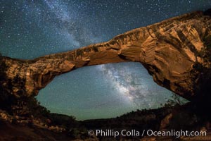
Owachomo Bridge and Milky Way. Owachomo Bridge, a natural stone bridge standing 106' high and spanning 130' wide,stretches across a canyon with the Milky Way crossing the night sky.
Location: Owachomo Bridge, Natural Bridges National Monument, Utah
Image ID: 28545
Location: Owachomo Bridge, Natural Bridges National Monument, Utah
Image ID: 28545
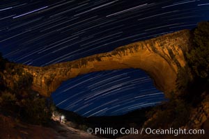
Owachomo Bridge and Star Trails, at night. Owachomo Bridge, a natural stone bridge standing 106' high and spanning 130' wide,stretches across a canyon with the Milky Way crossing the night sky.
Location: Owachomo Bridge, Natural Bridges National Monument, Utah
Image ID: 28550
Location: Owachomo Bridge, Natural Bridges National Monument, Utah
Image ID: 28550