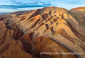
Aerial Photo of Raplee Ridge near Mexican Hat, Utah. Raplee Ridge is a spectacular series of multicolored triangular flatirons near the San Juan River. Often called "the Raplee Anticline" the geologic structure is in fact better described as a monocline, according to the Utah Geological Survey.
Location: Mexican Hat, Utah
Image ID: 39489
Location: Mexican Hat, Utah
Image ID: 39489
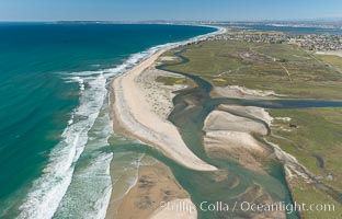
Aerial Photo of Tijuana River Mouth SMCA. Tijuana River Mouth State Marine Conservation Area borders Imperial Beach and the Mexican Border.
Location: Imperial Beach, California
Image ID: 30660
Location: Imperial Beach, California
Image ID: 30660
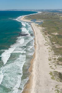
Aerial Photo of Tijuana River Mouth SMCA. Tijuana River Mouth State Marine Conservation Area borders Imperial Beach and the Mexican Border.
Location: Imperial Beach, California
Image ID: 30649
Location: Imperial Beach, California
Image ID: 30649
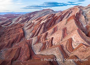
Aerial Photo of Raplee Ridge near Mexican Hat, Utah. Raplee Ridge is a spectacular series of multicolored triangular flatirons near the San Juan River. Often called "the Raplee Anticline" the geologic structure is in fact better described as a monocline, according to the Utah Geological Survey.
Location: Mexican Hat, Utah
Image ID: 39490
Location: Mexican Hat, Utah
Image ID: 39490
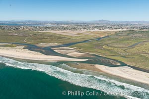
Aerial Photo of Tijuana River Mouth SMCA. Tijuana River Mouth State Marine Conservation Area borders Imperial Beach and the Mexican Border.
Location: Imperial Beach, California
Image ID: 30648
Location: Imperial Beach, California
Image ID: 30648
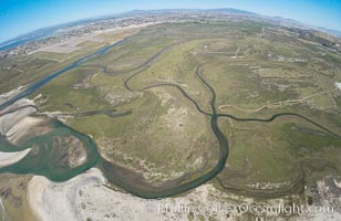
Aerial Photo of Tijuana River Mouth SMCA. Tijuana River Mouth State Marine Conservation Area borders Imperial Beach and the Mexican Border.
Location: Imperial Beach, California
Image ID: 30659
Location: Imperial Beach, California
Image ID: 30659
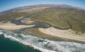
Aerial Photo of Tijuana River Mouth SMCA. Tijuana River Mouth State Marine Conservation Area borders Imperial Beach and the Mexican Border.
Location: Imperial Beach, California
Image ID: 30657
Location: Imperial Beach, California
Image ID: 30657
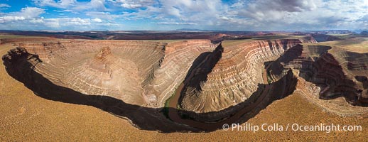
Goosenecks on the San Juan River near Lime Ridge, Utah. Deep canyons formed by the San Juan River near Mexican Hat are seen in this aerial panoramic photo.
Location: Mexican Hat, Utah
Image ID: 39487
Panorama dimensions: 4625 x 11971
Location: Mexican Hat, Utah
Image ID: 39487
Panorama dimensions: 4625 x 11971
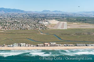
Aerial Photo of Tijuana River Mouth SMCA. Tijuana River Mouth State Marine Conservation Area borders Imperial Beach and the Mexican Border.
Location: Imperial Beach, California
Image ID: 30644
Location: Imperial Beach, California
Image ID: 30644
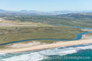
Aerial Photo of Tijuana River Mouth SMCA. Tijuana River Mouth State Marine Conservation Area borders Imperial Beach and the Mexican Border.
Location: Imperial Beach, California
Image ID: 30645
Location: Imperial Beach, California
Image ID: 30645
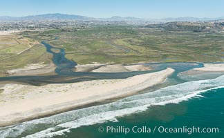
Aerial Photo of Tijuana River Mouth SMCA. Tijuana River Mouth State Marine Conservation Area borders Imperial Beach and the Mexican Border.
Location: Imperial Beach, California
Image ID: 30646
Location: Imperial Beach, California
Image ID: 30646
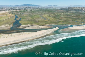
Aerial Photo of Tijuana River Mouth SMCA. Tijuana River Mouth State Marine Conservation Area borders Imperial Beach and the Mexican Border.
Location: Imperial Beach, California
Image ID: 30647
Location: Imperial Beach, California
Image ID: 30647
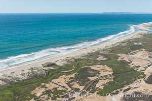
Aerial Photo of Tijuana River Mouth SMCA. Tijuana River Mouth State Marine Conservation Area borders Imperial Beach and the Mexican Border.
Location: Imperial Beach, California
Image ID: 30650
Location: Imperial Beach, California
Image ID: 30650
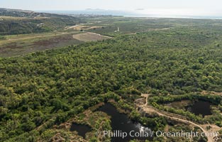
Aerial Photo of Tijuana River Mouth SMCA. Tijuana River Mouth State Marine Conservation Area borders Imperial Beach and the Mexican Border.
Location: Imperial Beach, California
Image ID: 30651
Location: Imperial Beach, California
Image ID: 30651
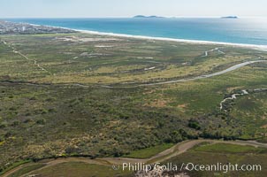
Aerial Photo of Tijuana River Mouth SMCA. Tijuana River Mouth State Marine Conservation Area borders Imperial Beach and the Mexican Border.
Location: Imperial Beach, California
Image ID: 30652
Location: Imperial Beach, California
Image ID: 30652
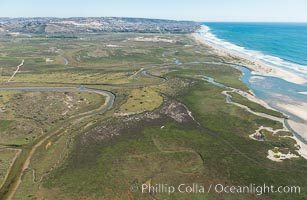
Aerial Photo of Tijuana River Mouth SMCA. Tijuana River Mouth State Marine Conservation Area borders Imperial Beach and the Mexican Border.
Location: Imperial Beach, California
Image ID: 30653
Location: Imperial Beach, California
Image ID: 30653
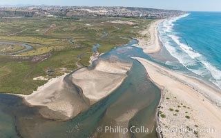
Aerial Photo of Tijuana River Mouth SMCA. Tijuana River Mouth State Marine Conservation Area borders Imperial Beach and the Mexican Border.
Location: Imperial Beach, California
Image ID: 30654
Location: Imperial Beach, California
Image ID: 30654
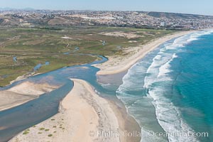
Aerial Photo of Tijuana River Mouth SMCA. Tijuana River Mouth State Marine Conservation Area borders Imperial Beach and the Mexican Border.
Location: Imperial Beach, California
Image ID: 30655
Location: Imperial Beach, California
Image ID: 30655
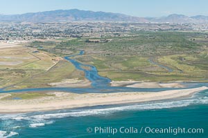
Aerial Photo of Tijuana River Mouth SMCA. Tijuana River Mouth State Marine Conservation Area borders Imperial Beach and the Mexican Border.
Location: Imperial Beach, California
Image ID: 30656
Location: Imperial Beach, California
Image ID: 30656
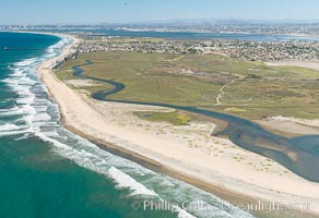
Aerial Photo of Tijuana River Mouth SMCA. Tijuana River Mouth State Marine Conservation Area borders Imperial Beach and the Mexican Border.
Location: Imperial Beach, California
Image ID: 30658
Location: Imperial Beach, California
Image ID: 30658
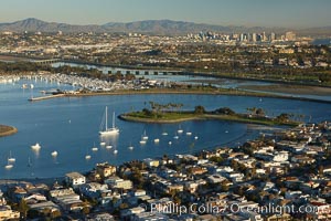
Mission Bay is the largest man-made aquatic park in the country. It spans 4,235 acres and is split nearly evenly between land and water. It is situated between the communities of Pacific Beach, Mission Beach, Bay Park and bordered on the south by the San Diego River channel. Once named "False Bay" by Juan Cabrillo in 1542, the tidelands were dredged in the 1940's creating the basins and islands of what is now Mission Bay.
Location: San Diego, California
Image ID: 22324
Location: San Diego, California
Image ID: 22324
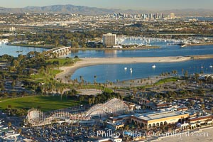
Mission Bay, is the largest man-made aquatic park in the country. It spans 4,235 acres and is split nearly evenly between land and water. It is situated between the communities of Pacific Beach, Mission Beach, Bay Park and bordered on the south by the San Diego River channel. Once named "False Bay" by Juan Cabrillo in 1542, the tidelands were dredged in the 1940's creating the basins and islands of what is now Mission Bay.
Location: San Diego, California
Image ID: 22381
Location: San Diego, California
Image ID: 22381
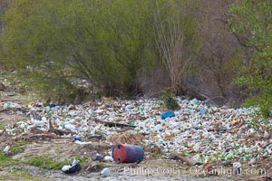
Pollution accumulates in the Tijuana River Valley following winter storms which flush the trash from Tijuana in Mexico across the border into the United States.
Location: Imperial Beach, San Diego, California
Image ID: 22544
Location: Imperial Beach, San Diego, California
Image ID: 22544
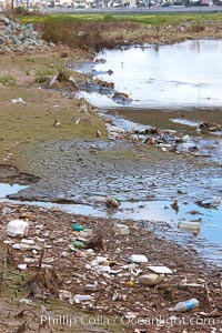
Pollution accumulates in the Tijuana River Valley following winter storms which flush the trash from Tijuana in Mexico across the border into the United States.
Location: Imperial Beach, San Diego, California
Image ID: 22545
Location: Imperial Beach, San Diego, California
Image ID: 22545
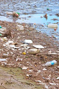
Pollution accumulates in the Tijuana River Valley following winter storms which flush the trash from Tijuana in Mexico across the border into the United States.
Location: Imperial Beach, San Diego, California
Image ID: 22546
Location: Imperial Beach, San Diego, California
Image ID: 22546
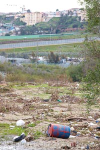
Pollution accumulates in the Tijuana River Valley following winter storms which flush the trash from Tijuana in Mexico across the border into the United States.
Location: Imperial Beach, San Diego, California
Image ID: 22547
Location: Imperial Beach, San Diego, California
Image ID: 22547
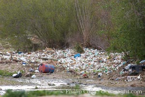
Pollution accumulates in the Tijuana River Valley following winter storms which flush the trash from Tijuana in Mexico across the border into the United States.
Location: Imperial Beach, San Diego, California
Image ID: 22548
Location: Imperial Beach, San Diego, California
Image ID: 22548
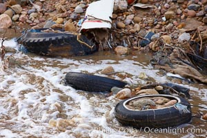
Pollution accumulates in the Tijuana River Valley following winter storms which flush the trash from Tijuana in Mexico across the border into the United States.
Location: Imperial Beach, San Diego, California
Image ID: 22549
Location: Imperial Beach, San Diego, California
Image ID: 22549
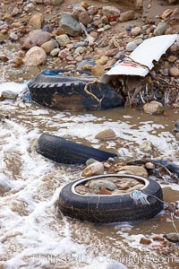
Pollution accumulates in the Tijuana River Valley following winter storms which flush the trash from Tijuana in Mexico across the border into the United States.
Location: Imperial Beach, San Diego, California
Image ID: 22550
Location: Imperial Beach, San Diego, California
Image ID: 22550
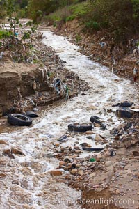
Pollution accumulates in the Tijuana River Valley following winter storms which flush the trash from Tijuana in Mexico across the border into the United States.
Location: Imperial Beach, San Diego, California
Image ID: 22551
Location: Imperial Beach, San Diego, California
Image ID: 22551