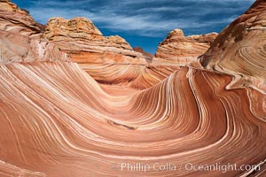
The Wave, an area of fantastic eroded sandstone featuring beautiful swirls, wild colors, countless striations, and bizarre shapes set amidst the dramatic surrounding North Coyote Buttes of Arizona and Utah. The sandstone formations of the North Coyote Buttes, including the Wave, date from the Jurassic period. Managed by the Bureau of Land Management, the Wave is located in the Paria Canyon-Vermilion Cliffs Wilderness and is accessible on foot by permit only.
Location: North Coyote Buttes, Paria Canyon-Vermilion Cliffs Wilderness, Arizona
Image ID: 20605
Location: North Coyote Buttes, Paria Canyon-Vermilion Cliffs Wilderness, Arizona
Image ID: 20605
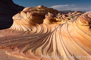
The Second Wave at Sunset, North Coyote Buttes. The Second Wave, a curiously-shaped sandstone swirl, takes on rich warm tones and dramatic shadowed textures at sunset. Set in the North Coyote Buttes of Arizona and Utah, the Second Wave is characterized by striations revealing layers of sedimentary deposits, a visible historical record depicting eons of submarine geology.
Location: North Coyote Buttes, Paria Canyon-Vermilion Cliffs Wilderness, Arizona
Image ID: 20606
Location: North Coyote Buttes, Paria Canyon-Vermilion Cliffs Wilderness, Arizona
Image ID: 20606
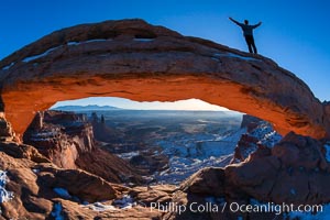
Extended High Mountain pose, Utthita Tadasana, sunrise on Mesa Arch, Utah. A lone hiker greets the dawning sun from atop Mesa Arch.
Location: Island in the Sky, Canyonlands National Park, Utah
Image ID: 18036
Location: Island in the Sky, Canyonlands National Park, Utah
Image ID: 18036
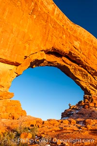
Hiker in North Window, sunset, western face. North Window is a natural sandstone arch 90 feet wide and 48 feet high.
Location: North Window, Arches National Park, Utah
Image ID: 18159
Location: North Window, Arches National Park, Utah
Image ID: 18159
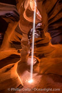
Light Beam in Upper Antelope Slot Canyon. Thin shafts of light briefly penetrate the convoluted narrows of Upper Antelope Slot Canyon, sending piercing beams through the sandstone maze to the sand floor below.
Location: Navajo Tribal Lands, Page, Arizona
Image ID: 28570
Location: Navajo Tribal Lands, Page, Arizona
Image ID: 28570
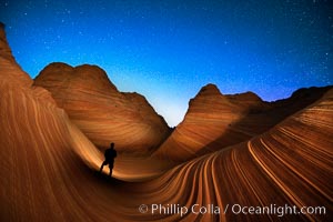
The Wave at Night, under a clear night sky full of stars. Photographer is illuminating the striated rocks with a small handheld light. The Wave, an area of fantastic eroded sandstone featuring beautiful swirls, wild colors, countless striations, and bizarre shapes is set amidst the dramatic surrounding North Coyote Buttes of Arizona and Utah. The sandstone formations of the North Coyote Buttes, including the Wave, date from the Jurassic period. Managed by the Bureau of Land Management, the Wave is located in the Paria Canyon-Vermilion Cliffs Wilderness and is accessible on foot by permit only.
Location: North Coyote Buttes, Paria Canyon-Vermilion Cliffs Wilderness, Arizona
Image ID: 28620
Location: North Coyote Buttes, Paria Canyon-Vermilion Cliffs Wilderness, Arizona
Image ID: 28620
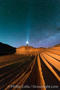
The Second Wave at Night. The Second Wave, a spectacular sandstone formation in the North Coyote Buttes, lies under a sky full of stars.
Location: North Coyote Buttes, Paria Canyon-Vermilion Cliffs Wilderness, Arizona
Image ID: 28627
Location: North Coyote Buttes, Paria Canyon-Vermilion Cliffs Wilderness, Arizona
Image ID: 28627
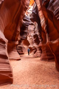
A hiker admiring the striated walls and dramatic light within Antelope Canyon, a deep narrow slot canyon formed by water and wind erosion.
Location: Navajo Tribal Lands, Page, Arizona
Image ID: 17993
Location: Navajo Tribal Lands, Page, Arizona
Image ID: 17993
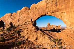
Tracy greets the dawn, with Turret Arch in the distance viewed through North Window at Sunrise.
Location: North Window, Arches National Park, Utah
Image ID: 37860
Location: North Window, Arches National Park, Utah
Image ID: 37860
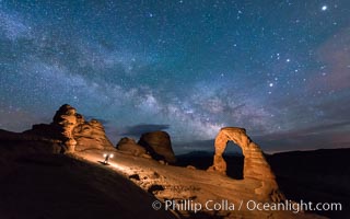
Light Painting and the Milky Way and Stars over Delicate Arch, at night, Arches National Park, Utah.
Location: Delicate Arch, Arches National Park, Utah
Image ID: 29288
Location: Delicate Arch, Arches National Park, Utah
Image ID: 29288
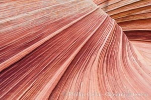
The Wave, an area of fantastic eroded sandstone featuring beautiful swirls, wild colors, countless striations, and bizarre shapes set amidst the dramatic surrounding North Coyote Buttes of Arizona and Utah. The sandstone formations of the North Coyote Buttes, including the Wave, date from the Jurassic period. Managed by the Bureau of Land Management, the Wave is located in the Paria Canyon-Vermilion Cliffs Wilderness and is accessible on foot by permit only.
Location: North Coyote Buttes, Paria Canyon-Vermilion Cliffs Wilderness, Arizona
Image ID: 20607
Location: North Coyote Buttes, Paria Canyon-Vermilion Cliffs Wilderness, Arizona
Image ID: 20607
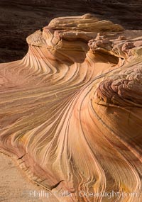
The Second Wave at Sunset, Vermillion Cliffs. The Second Wave, a curiously-shaped sandstone swirl, takes on rich warm tones and dramatic shadowed textures at sunset. Set in the North Coyote Buttes of Arizona and Utah, the Second Wave is characterized by striations revealing layers of sedimentary deposits, a visible historical record depicting eons of submarine geology.
Location: North Coyote Buttes, Paria Canyon-Vermilion Cliffs Wilderness, Arizona
Image ID: 28613
Location: North Coyote Buttes, Paria Canyon-Vermilion Cliffs Wilderness, Arizona
Image ID: 28613
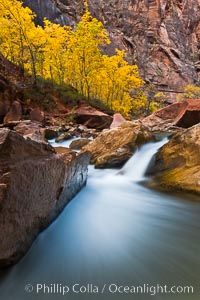
The Virgin River flows by autumn cottonwood trees, part of the Virgin River Narrows. This is a fantastic hike in fall with the comfortable temperatures, beautiful fall colors and light crowds.
Location: Virgin River Narrows, Zion National Park, Utah
Image ID: 26096
Location: Virgin River Narrows, Zion National Park, Utah
Image ID: 26096
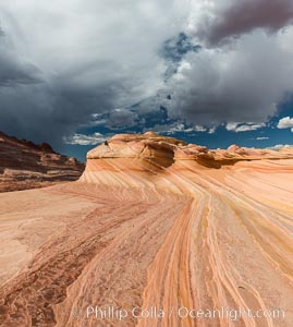
The Second Wave at sunset. The Second Wave, a curiously-shaped sandstone swirl, takes on rich warm tones and dramatic shadowed textures at sunset. Set in the North Coyote Buttes of Arizona and Utah, the Second Wave is characterized by striations revealing layers of sedimentary deposits, a visible historical record depicting eons of submarine geology.
Location: North Coyote Buttes, Paria Canyon-Vermilion Cliffs Wilderness, Arizona
Image ID: 28614
Location: North Coyote Buttes, Paria Canyon-Vermilion Cliffs Wilderness, Arizona
Image ID: 28614
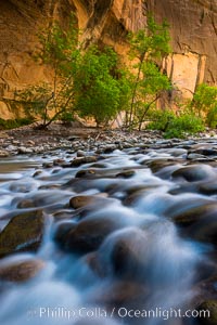
The Virgin River Narrows, where the Virgin River has carved deep, narrow canyons through the Zion National Park sandstone, creating one of the finest hikes in the world.
Location: Virgin River Narrows, Zion National Park, Utah
Image ID: 28575
Location: Virgin River Narrows, Zion National Park, Utah
Image ID: 28575
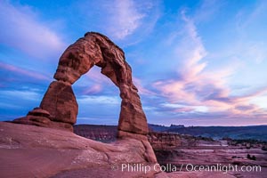
Delicate Arch at Sunset, Arches National Park.
Location: Delicate Arch, Arches National Park, Utah
Image ID: 29283
Location: Delicate Arch, Arches National Park, Utah
Image ID: 29283
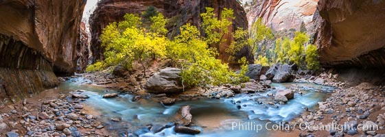
Fall Colors in the Virgin River Narrows, Zion National Park, Utah.
Location: Virgin River Narrows, Zion National Park, Utah
Image ID: 32634
Panorama dimensions: 5145 x 14424
Location: Virgin River Narrows, Zion National Park, Utah
Image ID: 32634
Panorama dimensions: 5145 x 14424
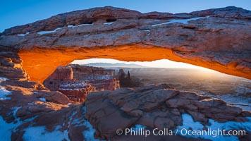
Mesa Arch spans 90 feet and stands at the edge of a mesa precipice thousands of feet above the Colorado River gorge. For a few moments at sunrise the underside of the arch glows dramatically red and orange.
Location: Island in the Sky, Canyonlands National Park, Utah
Image ID: 18040
Location: Island in the Sky, Canyonlands National Park, Utah
Image ID: 18040
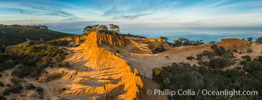
Broken Hill and view to La Jolla, panoramic photograph, from Torrey Pines State Reserve, sunrise.
Location: Torrey Pines State Reserve, San Diego, California
Image ID: 28397
Panorama dimensions: 4332 x 11344
Location: Torrey Pines State Reserve, San Diego, California
Image ID: 28397
Panorama dimensions: 4332 x 11344
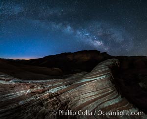
Milky Way galaxy rises above the Fire Wave, Valley of Fire State Park.
Location: Valley of Fire State Park, Nevada
Image ID: 28428
Location: Valley of Fire State Park, Nevada
Image ID: 28428
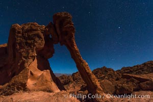
Elephant arch and stars at night, moonlight, Valley of Fire State Park.
Location: Valley of Fire State Park, Nevada
Image ID: 28435
Location: Valley of Fire State Park, Nevada
Image ID: 28435
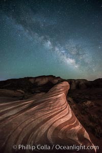
Milky Way galaxy rises above the Fire Wave, Valley of Fire State Park.
Location: Valley of Fire State Park, Nevada
Image ID: 28554
Location: Valley of Fire State Park, Nevada
Image ID: 28554
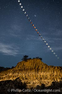
Lunar Eclipse Sequence Over Broken Hill, Torrey Pines State Reserve. While the moon lies in the full shadow of the earth (umbra) it receives only faint, red-tinged light refracted through the Earth's atmosphere. As the moon passes into the penumbra it receives increasing amounts of direct sunlight, eventually leaving the shadow of the Earth altogether. October 8, 2014.
Location: Torrey Pines State Reserve, San Diego, California
Image ID: 29412
Location: Torrey Pines State Reserve, San Diego, California
Image ID: 29412
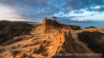
Clearing storm clouds over Broken Hill, overlooking La Jolla and the Pacific Ocean, Torrey Pines State Reserve.
Location: Torrey Pines State Reserve, San Diego, California
Image ID: 29416
Location: Torrey Pines State Reserve, San Diego, California
Image ID: 29416
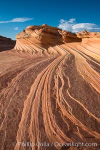
The Second Wave at Sunset, Vermillion Cliffs. The Second Wave, a curiously-shaped sandstone swirl, takes on rich warm tones and dramatic shadowed textures at sunset. Set in the North Coyote Buttes of Arizona and Utah, the Second Wave is characterized by striations revealing layers of sedimentary deposits, a visible historical record depicting eons of submarine geology.
Location: North Coyote Buttes, Paria Canyon-Vermilion Cliffs Wilderness, Arizona
Image ID: 28619
Location: North Coyote Buttes, Paria Canyon-Vermilion Cliffs Wilderness, Arizona
Image ID: 28619
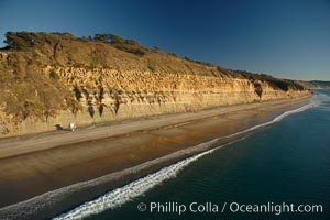
Torrey Pines seacliffs, rising up to 300 feet above the ocean, stretch from Del Mar to La Jolla. On the mesa atop the bluffs are found Torrey pine trees, one of the rare species of pines in the world.
Location: Torrey Pines State Reserve, San Diego, California
Image ID: 22285
Location: Torrey Pines State Reserve, San Diego, California
Image ID: 22285
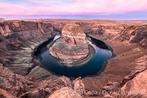
Spectacular Horseshoe Bend sunrise. The Colorado River makes a 180-degree turn at Horseshoe Bend. Here the river has eroded the Navajo sandstone for eons, digging a canyon 1100-feet deep.
Location: Horseshoe Bend, Page, Arizona
Image ID: 35939
Location: Horseshoe Bend, Page, Arizona
Image ID: 35939
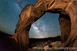
Milky Way and Stars over Broken Arch, Arches National Park, Utah.
Location: Broken Arch, Arches National Park, Utah
Image ID: 29238
Location: Broken Arch, Arches National Park, Utah
Image ID: 29238
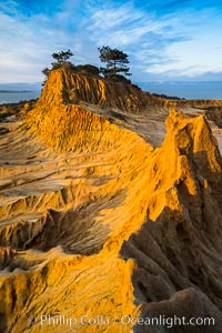
Torrey Pines State Reserve, Broken Hill at Dawn.
Location: Torrey Pines State Reserve, San Diego, California
Image ID: 29178
Location: Torrey Pines State Reserve, San Diego, California
Image ID: 29178
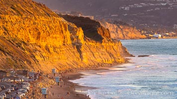
Torrey Pines State Beach at Sunset, La Jolla, Mount Soledad and Blacks Beach in the distance.
Location: Torrey Pines State Reserve, San Diego, California
Image ID: 35061
Location: Torrey Pines State Reserve, San Diego, California
Image ID: 35061