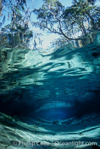
Three Sisters Springs depicted in an underwater landscape with sand, clear water and trees.
Location: Three Sisters Springs, Crystal River, Florida
Image ID: 02673
Location: Three Sisters Springs, Crystal River, Florida
Image ID: 02673
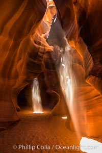
Light Beam in Upper Antelope Slot Canyon. Thin shafts of light briefly penetrate the convoluted narrows of Upper Antelope Slot Canyon, sending piercing beams through the sandstone maze to the sand floor below.
Location: Navajo Tribal Lands, Page, Arizona
Image ID: 28561
Location: Navajo Tribal Lands, Page, Arizona
Image ID: 28561
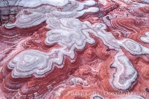
Fantastic colorful sedimentary patterns of Bentonite layers, seen as striations exposed in the Utah Badlands. The Bentonite Hills are composed of the Brushy Basin shale member of the Morrison Formation formed during Jurassic times when mud, silt, fine sand, and volcanic ash were deposited in swamps and lakes into layers, now revealed through erosion. Aerial photograph.
Location: Utah
Image ID: 37947
Location: Utah
Image ID: 37947
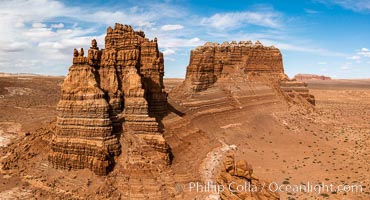
Molly's Castle, aerial view, Goblin Valley State Park. Curtis Formation whiteish caprock is on top, with reddish Entrada Sandstone below, both of Jurassic era. Molly's castle lies in the San Rafael desert near Goblin Valley, and drains into the Colorado River watershed. Aerial panoramic photograph.
Location: Goblin Valley State Park, Utah
Image ID: 37950
Location: Goblin Valley State Park, Utah
Image ID: 37950
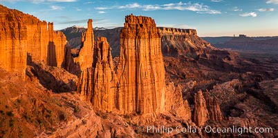
Fisher Towers at sunset, near Moab, Utah. Fisher Towers are a series of towers made of Cutler sandstone capped with Moenkopi sandstone and caked with a stucco of red mud located near Moab, Utah.
Location: Fisher Towers, Moab, Utah
Image ID: 38225
Location: Fisher Towers, Moab, Utah
Image ID: 38225
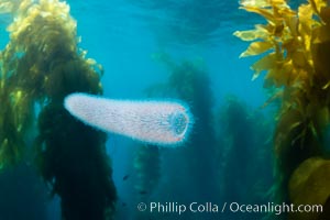
Pyrosome drifting through a kelp forest, Catalina Island. Pyrosomes are free-floating colonial tunicates that usually live in the upper layers of the open ocean in warm seas. Pyrosomes are cylindrical or cone-shaped colonies made up of hundreds to thousands of individuals, known as zooids.
Location: Catalina Island, California
Image ID: 37166
Location: Catalina Island, California
Image ID: 37166
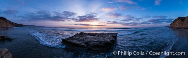
Sunset over Flat Rock on Torrey Pines State Beach.
Location: Torrey Pines State Reserve, San Diego, California
Image ID: 29105
Panorama dimensions: 3831 x 12302
Location: Torrey Pines State Reserve, San Diego, California
Image ID: 29105
Panorama dimensions: 3831 x 12302
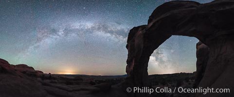
Milky Way and Stars over Broken Arch, Arches National Park, Utah.
Location: Broken Arch, Arches National Park, Utah
Image ID: 29237
Panorama dimensions: 5882 x 15117
Location: Broken Arch, Arches National Park, Utah
Image ID: 29237
Panorama dimensions: 5882 x 15117
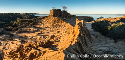
Broken Hill and view to La Jolla, panoramic photograph, from Torrey Pines State Reserve, sunrise.
Location: Torrey Pines State Reserve, San Diego, California
Image ID: 30469
Panorama dimensions: 6212 x 12960
Location: Torrey Pines State Reserve, San Diego, California
Image ID: 30469
Panorama dimensions: 6212 x 12960
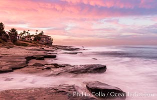
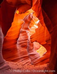
Lower Antelope Canyon, a deep, narrow and spectacular slot canyon lying on Navajo Tribal lands near Page, Arizona.
Location: Navajo Tribal Lands, Page, Arizona
Image ID: 26628
Location: Navajo Tribal Lands, Page, Arizona
Image ID: 26628
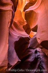
Lower Antelope Canyon, a deep, narrow and spectacular slot canyon lying on Navajo Tribal lands near Page, Arizona.
Location: Navajo Tribal Lands, Page, Arizona
Image ID: 28559
Location: Navajo Tribal Lands, Page, Arizona
Image ID: 28559
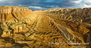
Aerial View of the San Rafael Reef, Utah. This is a canyon-like section of the San Rafael Reef, photographed at sunrise. The "reef proper" is on the right, with its characteristic triangular flatiron erosion. The canyon in the center is a fold in the Earth's crust affiliated with the boundary of the San Rafael Swell. The colors seen here arise primarily from Navajo and Wingate sandstone.
Location: Utah
Image ID: 39497
Panorama dimensions: 4490 x 8439
Location: Utah
Image ID: 39497
Panorama dimensions: 4490 x 8439
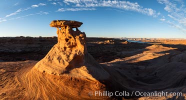
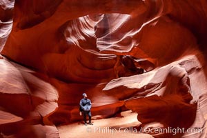
A hiker admiring the striated walls and dramatic light within Antelope Canyon, a deep narrow slot canyon formed by water and wind erosion.
Location: Navajo Tribal Lands, Page, Arizona
Image ID: 18009
Location: Navajo Tribal Lands, Page, Arizona
Image ID: 18009
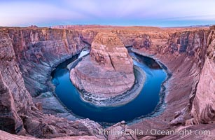
Belt of Venus over Horseshoe Bend on the Colorado River. The Colorado River makes a 180-degree turn at Horseshoe Bend. Here the river has eroded the Navajo sandstone for eons, digging a canyon 1100-feet deep. The Belt of Venus, or anti-twilight arch, is the shadow of the earth cast upon the atmosphere just above the horizon, and occurs a few minutes before sunrise or after sunset.
Location: Page, Arizona
Image ID: 37781
Panorama dimensions: 5719 x 8788
Location: Page, Arizona
Image ID: 37781
Panorama dimensions: 5719 x 8788
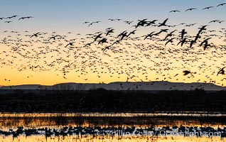
Snow geese fly in huge numbers at sunrise. Thousands of wintering snow geese take to the sky in predawn light in Bosque del Apache's famous "blast off". The flock can be as large as 20,000 geese or more.
Species: Snow goose, Chen caerulescens
Location: Bosque del Apache National Wildlife Refuge, Socorro, New Mexico
Image ID: 38742
Species: Snow goose, Chen caerulescens
Location: Bosque del Apache National Wildlife Refuge, Socorro, New Mexico
Image ID: 38742
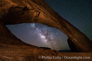
Milky Way and Stars through Wilson Arch. Wilson Arch rises high above route 191 in eastern Utah, with a span of 91 feet and a height of 46 feet.
Location: Wilson Arch, Moab, Utah
Image ID: 29275
Location: Wilson Arch, Moab, Utah
Image ID: 29275
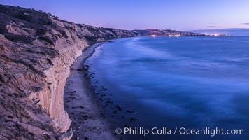
Torrey Pines cliffs at sunset.
Location: Torrey Pines State Reserve, San Diego, California
Image ID: 29112
Location: Torrey Pines State Reserve, San Diego, California
Image ID: 29112
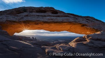
Mesa Arch Sunrise, Canyonlands National Park, Utah.
Location: Mesa Arch, Canyonlands National Park, Utah
Image ID: 29304
Location: Mesa Arch, Canyonlands National Park, Utah
Image ID: 29304
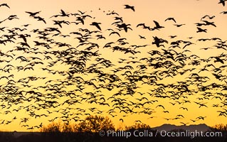
Snow geese fly in huge numbers at sunrise. Thousands of wintering snow geese take to the sky in predawn light in Bosque del Apache's famous "blast off". The flock can be as large as 20,000 geese or more.
Species: Snow goose, Chen caerulescens
Location: Bosque del Apache National Wildlife Refuge, Socorro, New Mexico
Image ID: 38715
Species: Snow goose, Chen caerulescens
Location: Bosque del Apache National Wildlife Refuge, Socorro, New Mexico
Image ID: 38715
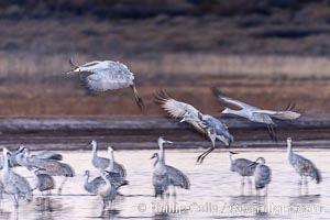
Sandhill cranes landing in water ponds at dusk, spending the night standing in water as a protection against coyotes and other predators. Motion blur.
Species: Sandhill crane, Grus canadensis
Location: Bosque del Apache National Wildlife Refuge, Socorro, New Mexico
Image ID: 38731
Species: Sandhill crane, Grus canadensis
Location: Bosque del Apache National Wildlife Refuge, Socorro, New Mexico
Image ID: 38731
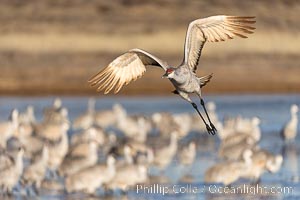
Sandhill Crane in Flight at Sunrise, Bosque del Apache NWR. At sunrise, sandhill cranes will fly out from the pool in which they spent the night to range over Bosque del Apache NWR in search of food, returning to the pool at sunset.
Species: Sandhill crane, Grus canadensis
Location: Bosque del Apache National Wildlife Refuge, Socorro, New Mexico
Image ID: 38733
Species: Sandhill crane, Grus canadensis
Location: Bosque del Apache National Wildlife Refuge, Socorro, New Mexico
Image ID: 38733
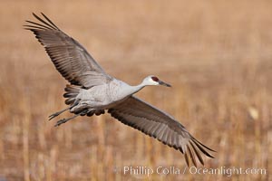
Sandhill crane in flight, wings extended.
Species: Sandhill crane, Grus canadensis
Location: Bosque Del Apache, Socorro, New Mexico
Image ID: 26197
Species: Sandhill crane, Grus canadensis
Location: Bosque Del Apache, Socorro, New Mexico
Image ID: 26197
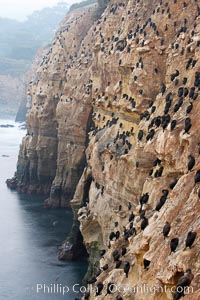
Cormorants rest on sandstone seacliffs above the ocean. Likely Brandts and double-crested cormorants.
Species: Cormorants, Brandt's Cormorant, Phalacrocorax, Phalacrocorax penicillatus
Location: La Jolla, California
Image ID: 18345
Species: Cormorants, Brandt's Cormorant, Phalacrocorax, Phalacrocorax penicillatus
Location: La Jolla, California
Image ID: 18345
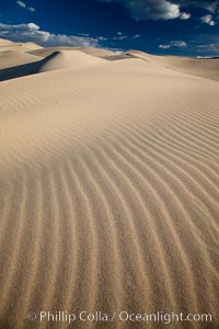
Eureka Dunes. The Eureka Valley Sand Dunes are California's tallest sand dunes, and one of the tallest in the United States. Rising 680' above the floor of the Eureka Valley, the Eureka sand dunes are home to several endangered species, as well as "singing sand" that makes strange sounds when it shifts. Located in the remote northern portion of Death Valley National Park, the Eureka Dunes see very few visitors.
Location: Eureka Dunes, Death Valley National Park, California
Image ID: 25250
Location: Eureka Dunes, Death Valley National Park, California
Image ID: 25250
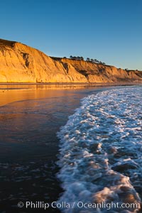
Torrey Pines State Beach, sandstone cliffs rise above the beach at Torrey Pines State Reserve.
Location: Torrey Pines State Reserve, San Diego, California
Image ID: 27248
Location: Torrey Pines State Reserve, San Diego, California
Image ID: 27248
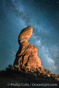
Balanced Rock and Milky Way stars at night.
Location: Balanced Rock, Arches National Park, Utah
Image ID: 27835
Location: Balanced Rock, Arches National Park, Utah
Image ID: 27835
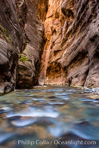
The Virgin River Narrows, where the Virgin River has carved deep, narrow canyons through the Zion National Park sandstone, creating one of the finest hikes in the world.
Location: Virgin River Narrows, Zion National Park, Utah
Image ID: 28578
Location: Virgin River Narrows, Zion National Park, Utah
Image ID: 28578
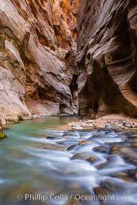
The Virgin River Narrows, where the Virgin River has carved deep, narrow canyons through the Zion National Park sandstone, creating one of the finest hikes in the world.
Location: Virgin River Narrows, Zion National Park, Utah
Image ID: 28579
Location: Virgin River Narrows, Zion National Park, Utah
Image ID: 28579