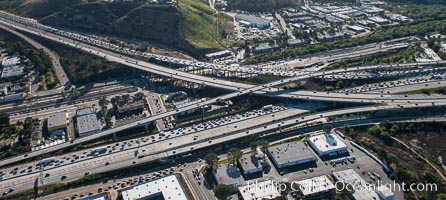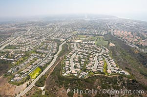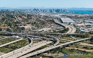
Aerial Photo of Downtown San Diego and Freeway Interchange.
Location: San Diego, California
Image ID: 30685
Location: San Diego, California
Image ID: 30685
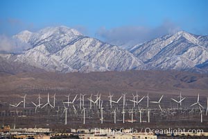
Wind turbines and Mount San Gorgonio Pass, near Interstate 10, provide electricity to Palm Springs and the Coachella Valley.
Location: San Gorgonio Pass, Palm Springs, California
Image ID: 22236
Location: San Gorgonio Pass, Palm Springs, California
Image ID: 22236
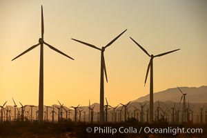
Wind turbines at sunrise, in the San Gorgonio Pass, near Interstate 10 provide electricity to Palm Springs and the Coachella Valley.
Location: San Gorgonio Pass, Palm Springs, California
Image ID: 22242
Location: San Gorgonio Pass, Palm Springs, California
Image ID: 22242
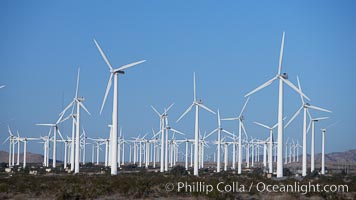
Wind turbines, in the San Gorgonio Pass, near Interstate 10 provide electricity to Palm Springs and the Coachella Valley.
Location: San Gorgonio Pass, Palm Springs, California
Image ID: 22239
Location: San Gorgonio Pass, Palm Springs, California
Image ID: 22239
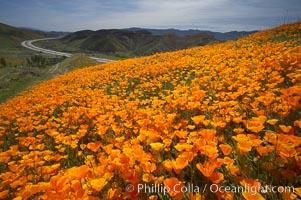
California poppies cover the hills in a brilliant springtime bloom. Interstate 15 I-15 is seen in the distance.
Species: California poppy, Eschscholtzia californica, Eschscholzia californica
Location: Elsinore, California
Image ID: 20494
Species: California poppy, Eschscholtzia californica, Eschscholzia californica
Location: Elsinore, California
Image ID: 20494
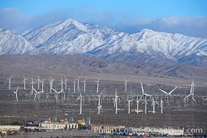
Wind turbines and Mount San Gorgonio Pass, near Interstate 10, provide electricity to Palm Springs and the Coachella Valley.
Location: San Gorgonio Pass, Palm Springs, California
Image ID: 22237
Location: San Gorgonio Pass, Palm Springs, California
Image ID: 22237
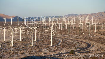
Wind turbines, in the San Gorgonio Pass, near Interstate 10 provide electricity to Palm Springs and the Coachella Valley.
Location: San Gorgonio Pass, Palm Springs, California
Image ID: 22238
Location: San Gorgonio Pass, Palm Springs, California
Image ID: 22238
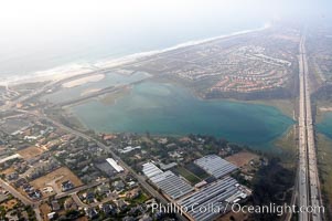
Batiquitos Lagoon aerial view, showing coastline and Interstate 5 freeway.
Location: Carlsbad, California
Image ID: 21337
Location: Carlsbad, California
Image ID: 21337
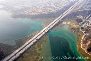
Batiquitos Lagoon aerial view, showing coastline and Interstate 5 freeway.
Location: Carlsbad, California
Image ID: 21338
Location: Carlsbad, California
Image ID: 21338
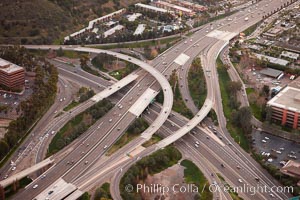
Freeway intersection, Interstate 8 and Highway 163, looking west.
Location: San Diego, California
Image ID: 22392
Location: San Diego, California
Image ID: 22392
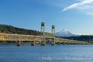
The Hood River Bridge is a truss bridge with a vertical lift that spans the Columbia River between Hood River, Oregon and White Salmon, Washington. The bridge is currently the second oldest road bridge across the Columbia between Washington and Oregon. It was built by the Oregon-Washington Bridge Company and opened on December 9, 1924. The original name was the Waucoma Interstate Bridge.
Location: Columbia River, Hood River, Oregon
Image ID: 19369
Location: Columbia River, Hood River, Oregon
Image ID: 19369
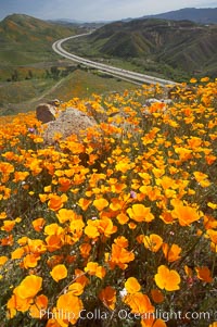
California poppies cover the hills in a brilliant springtime bloom. Interstate 15 I-15 is seen in the distance.
Species: California poppy, Eschscholtzia californica, Eschscholzia californica
Location: Elsinore, California
Image ID: 20519
Species: California poppy, Eschscholtzia californica, Eschscholzia californica
Location: Elsinore, California
Image ID: 20519
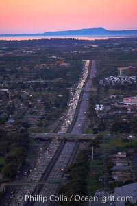
Interstate 805, rushhour traffic at sunset, looking north with the hills of Camp Pendleton and Oceanside in the distance.
Location: San Diego, California
Image ID: 22317
Location: San Diego, California
Image ID: 22317
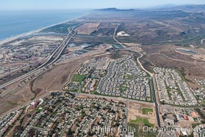
Camp Pendleton, viewed toward the north, including Pacific ocean and Interstate 5 freeway. Marine Corps Base Camp Pendleton.
Location: Marine Corps Base Camp Pendleton, California
Image ID: 25995
Location: Marine Corps Base Camp Pendleton, California
Image ID: 25995
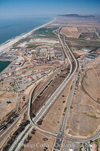
Camp Pendleton, viewed toward the north, including Pacific ocean and Interstate 5 freeway. Marine Corps Base Camp Pendleton.
Location: Marine Corps Base Camp Pendleton, California
Image ID: 25996
Location: Marine Corps Base Camp Pendleton, California
Image ID: 25996
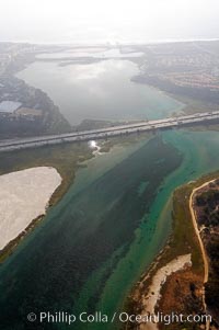
Batiquitos Lagoon aerial view, showing coastline and Interstate 5 freeway.
Location: Carlsbad, California
Image ID: 21339
Location: Carlsbad, California
Image ID: 21339
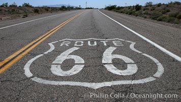
Route 66 (also known as U.S. Route 66, The Main Street of America, The Mother Road and the Will Rogers Highway) was a highway in the U.S. Highway system. One of the original federal routes, US 66 was established in 1926 and originally ran from Chicago through Missouri, Kansas, Oklahoma, Texas, New Mexico, Arizona, and California, before ending at Los Angeles for a total of 2,448 miles. US 66 was officially decommissioned (i.e., removed from the offical U.S. Highway system) in 1985 after it was decided the route was no longer relevant and had been replaced by the Interstate Highway System.
Location: California
Image ID: 20567
Location: California
Image ID: 20567
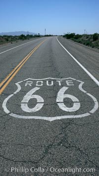
Route 66 (also known as U.S. Route 66, The Main Street of America, The Mother Road and the Will Rogers Highway) was a highway in the U.S. Highway system. One of the original federal routes, US 66 was established in 1926 and originally ran from Chicago through Missouri, Kansas, Oklahoma, Texas, New Mexico, Arizona, and California, before ending at Los Angeles for a total of 2,448 miles. US 66 was officially decommissioned (i.e., removed from the offical U.S. Highway system) in 1985 after it was decided the route was no longer relevant and had been replaced by the Interstate Highway System.
Location: California
Image ID: 20593
Location: California
Image ID: 20593
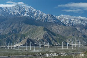
Wind turbines overlooking Interstate 10 provide electricity to Palm Springs and the Coachella Valley. San Gorgonio pass, San Bernardino mountains.
Location: San Gorgonio Pass, Palm Springs, California
Image ID: 06853
Location: San Gorgonio Pass, Palm Springs, California
Image ID: 06853
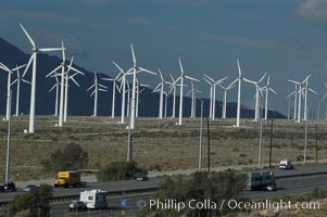
Wind turbines overlooking Interstate 10 provide electricity to Palm Springs and the Coachella Valley. San Gorgonio pass, San Bernardino mountains.
Location: San Gorgonio Pass, Palm Springs, California
Image ID: 06871
Location: San Gorgonio Pass, Palm Springs, California
Image ID: 06871
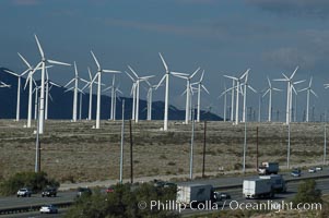
Wind turbines overlooking Interstate 10 provide electricity to Palm Springs and the Coachella Valley. San Gorgonio pass, San Bernardino mountains.
Location: San Gorgonio Pass, Palm Springs, California
Image ID: 06872
Location: San Gorgonio Pass, Palm Springs, California
Image ID: 06872
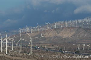
Wind turbines overlooking Interstate 10 provide electricity to Palm Springs and the Coachella Valley. San Gorgonio pass, San Bernardino mountains.
Location: San Gorgonio Pass, Palm Springs, California
Image ID: 06913
Location: San Gorgonio Pass, Palm Springs, California
Image ID: 06913
