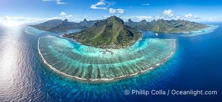
Barrier Reef around Moorea Island, French Polynesia. Cook's Bay to the left, Opunohu Bay to the right. The outer reef slope is seen adjacent to deep blue oceanic water with white waves breaking against the reef edge. Next, a wide shallow reef flat occurs dotted with coral bommies. Inside of that, a shallow protected lagoon is formed against the island. Tall, rugged, eroded mountains are seen hinting at the age of the ancient volcano that originally formed the island and that is now sinking back down, leaving the encircling reef behind.
Location: Moorea, French Polynesia, France
Image ID: 40676
Panorama dimensions: 5501 x 11925
Location: Moorea, French Polynesia, France
Image ID: 40676
Panorama dimensions: 5501 x 11925
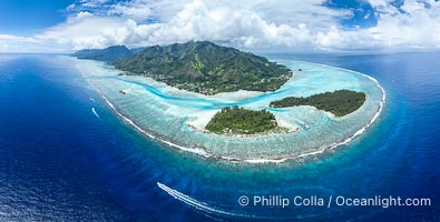
Barrier Reef around Moorea Island, French Polynesia. Motu Tiahura (left) and Motu Fareone (right) are the small islands in the foreground. The outer reef slope is seen adjacent to deep blue oceanic water with white waves breaking against the reef edge. Next, a wide shallow reef flat occurs dotted with coral bommies. Inside of that, a shallow protected lagoon is formed against the island. Tall, rugged, eroded mountains are seen hinting at the age of the ancient volcano that originally formed the island and that is now sinking back down, leaving the encircling reef behind.
Location: Moorea, French Polynesia, France
Image ID: 40614
Panorama dimensions: 5717 x 11305
Location: Moorea, French Polynesia, France
Image ID: 40614
Panorama dimensions: 5717 x 11305

Self portrait at sunrise, panorama of Crater Lake. Crater Lake is the six-mile wide lake inside the collapsed caldera of volcanic Mount Mazama. Crater Lake is the deepest lake in the United States and the seventh-deepest in the world. Its maximum recorded depth is 1996 feet (608m). It lies at an altitude of 6178 feet (1880m).
Location: Crater Lake National Park, Oregon
Image ID: 19130
Panorama dimensions: 2726 x 9677
Location: Crater Lake National Park, Oregon
Image ID: 19130
Panorama dimensions: 2726 x 9677
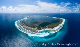
Aerial panorama of Clipperton Island, showing the entire atoll. Clipperton Rock, the top of an old volcano, is at middle bottom. Clipperton Island, a minor territory of France also known as Ile de la Passion, is a small (2.3 sq mi) but spectacular coral atoll in the eastern Pacific. By permit HC / 1485 / CAB (France).
Location: Clipperton Island, France
Image ID: 32835
Panorama dimensions: 5523 x 9328
Location: Clipperton Island, France
Image ID: 32835
Panorama dimensions: 5523 x 9328
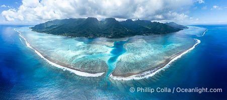
Barrier Reef around Moorea Island, French Polynesia. Nu'urua and Iumaru communities along the coast. The outer reef slope is seen adjacent to deep blue oceanic water with white waves breaking against the reef edge. Next, a wide shallow reef flat occurs dotted with coral bommies. Inside of that, a shallow protected lagoon is formed against the island. Tall, rugged, eroded mountains are seen hinting at the age of the ancient volcano that originally formed the island and that is now sinking back down, leaving the encircling reef behind.
Location: Moorea, French Polynesia, France
Image ID: 40666
Panorama dimensions: 5505 x 12416
Location: Moorea, French Polynesia, France
Image ID: 40666
Panorama dimensions: 5505 x 12416
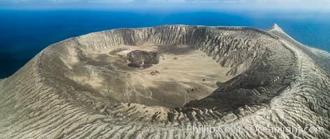
Barcena volcano crater, highest point on San Benedicto Island, Revillagigedos, Mexico.
Location: San Benedicto Island (Islas Revillagigedos), Baja California, Mexico
Image ID: 32922
Panorama dimensions: 3742 x 8857
Location: San Benedicto Island (Islas Revillagigedos), Baja California, Mexico
Image ID: 32922
Panorama dimensions: 3742 x 8857
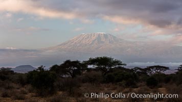
Mount Kilimanjaro, Tanzania, viewed from Amboseli National Park, Kenya.
Location: Amboseli National Park, Kenya
Image ID: 29540
Location: Amboseli National Park, Kenya
Image ID: 29540
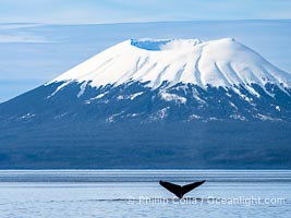
Mount Edgecumbe seen from the Sitka Sound. A volcano, Mount Edgecumbe has an elevation of 3201 feet and lies on the tip of Kruzof Island about 24 miles west of Sitka.
Species: Humpback whale, Megaptera novaeangliae
Location: Mount Edgecumbe, Sitka, Alaska
Image ID: 40956
Species: Humpback whale, Megaptera novaeangliae
Location: Mount Edgecumbe, Sitka, Alaska
Image ID: 40956
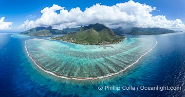
Barrier Reef around Moorea Island, French Polynesia. Cook's Bay to the left, Opunohu Bay to the right. The outer reef slope is seen adjacent to deep blue oceanic water with white waves breaking against the reef edge. Next, a wide shallow reef flat occurs dotted with coral bommies. Inside of that, a shallow protected lagoon is formed against the island. Tall, rugged, eroded mountains are seen hinting at the age of the ancient volcano that originally formed the island and that is now sinking back down, leaving the encircling reef behind.
Location: Moorea, French Polynesia, France
Image ID: 40673
Panorama dimensions: 6073 x 11526
Location: Moorea, French Polynesia, France
Image ID: 40673
Panorama dimensions: 6073 x 11526
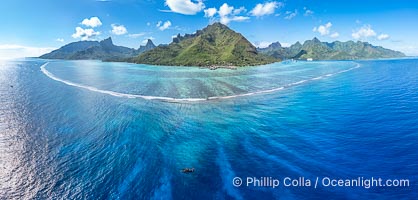
Barrier Reef around Moorea Island, French Polynesia. The outer reef slope is seen adjacent to deep blue oceanic water with white waves breaking against the reef edge. Next, a wide shallow reef flat occurs dotted with coral bommies. Inside of that, a shallow protected lagoon is formed against the island. Tall, rugged, eroded mountains are seen hinting at the age of the ancient volcano that originally formed the island and that is now sinking back down, leaving the encircling reef behind.
Location: Moorea, French Polynesia, France
Image ID: 40677
Panorama dimensions: 5104 x 10658
Location: Moorea, French Polynesia, France
Image ID: 40677
Panorama dimensions: 5104 x 10658
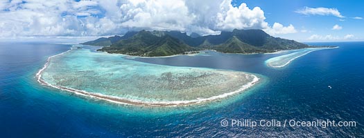
Barrier Reef around Moorea Island, French Polynesia. The outer reef slope is seen adjacent to deep blue oceanic water with white waves breaking against the reef edge. Next, a wide shallow reef flat occurs dotted with coral bommies. Inside of that, a shallow protected lagoon is formed against the island. Tall, rugged, eroded mountains are seen hinting at the age of the ancient volcano that originally formed the island and that is now sinking back down, leaving the encircling reef behind.
Location: Moorea, French Polynesia, France
Image ID: 40678
Panorama dimensions: 4911 x 12893
Location: Moorea, French Polynesia, France
Image ID: 40678
Panorama dimensions: 4911 x 12893
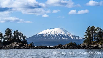
Mount Edgecumbe seen from the Sitka Sound. A volcano, Mount Edgecumbe has an elevation of 3201 feet and lies on the tip of Kruzof Island about 24 miles west of Sitka.
Location: Mount Edgecumbe, Sitka, Alaska
Image ID: 40958
Panorama dimensions: 5308 x 9437
Location: Mount Edgecumbe, Sitka, Alaska
Image ID: 40958
Panorama dimensions: 5308 x 9437

Panorama of Mount St. Helens, viewed from Johnston Ridge.
Location: Mount St. Helens National Volcanic Monument, Washington
Image ID: 19118
Panorama dimensions: 3058 x 14970
Location: Mount St. Helens National Volcanic Monument, Washington
Image ID: 19118
Panorama dimensions: 3058 x 14970
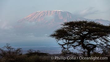
Mount Kilimanjaro, Tanzania, viewed from Amboseli NP, Kenya.
Location: Amboseli National Park, Kenya
Image ID: 29560
Location: Amboseli National Park, Kenya
Image ID: 29560
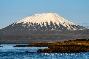
Mount Edgecumbe seen from the Sitka Sound. A volcano, Mount Edgecumbe has an elevation of 3201 feet and lies on the tip of Kruzof Island about 24 miles west of Sitka.
Location: Mount Edgecumbe, Sitka, Alaska
Image ID: 40959
Location: Mount Edgecumbe, Sitka, Alaska
Image ID: 40959
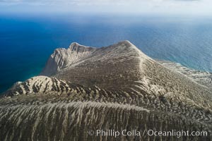
Barcena volcano crater, highest point on San Benedicto Island, Revillagigedos, Mexico.
Location: San Benedicto Island (Islas Revillagigedos), Baja California, Mexico
Image ID: 32920
Location: San Benedicto Island (Islas Revillagigedos), Baja California, Mexico
Image ID: 32920
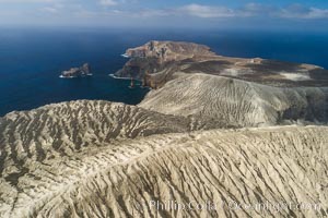
Barcena volcano crater, highest point on San Benedicto Island, Revillagigedos, Mexico.
Location: San Benedicto Island (Islas Revillagigedos), Baja California, Mexico
Image ID: 32921
Location: San Benedicto Island (Islas Revillagigedos), Baja California, Mexico
Image ID: 32921
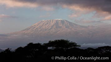
Mount Kilimanjaro, Tanzania, viewed from Amboseli NP, Kenya.
Location: Amboseli National Park, Kenya
Image ID: 29539
Location: Amboseli National Park, Kenya
Image ID: 29539
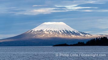
Mount Edgecumbe seen from the Sitka Sound. A volcano, Mount Edgecumbe has an elevation of 3201 feet and lies on the tip of Kruzof Island about 24 miles west of Sitka.
Location: Mount Edgecumbe, Sitka, Alaska
Image ID: 40960
Panorama dimensions: 4729 x 8407
Location: Mount Edgecumbe, Sitka, Alaska
Image ID: 40960
Panorama dimensions: 4729 x 8407
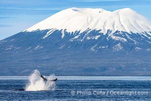
Mount Edgecumbe seen from the Sitka Sound. A volcano, Mount Edgecumbe has an elevation of 3201 feet and lies on the tip of Kruzof Island about 24 miles west of Sitka.
Species: Humpback whale, Megaptera novaeangliae
Location: Mount Edgecumbe, Sitka, Alaska
Image ID: 40961
Species: Humpback whale, Megaptera novaeangliae
Location: Mount Edgecumbe, Sitka, Alaska
Image ID: 40961
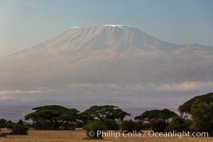
Mount Kilimanjaro, Tanzania, viewed from Amboseli NP, Kenya.
Location: Amboseli National Park, Kenya
Image ID: 29601
Location: Amboseli National Park, Kenya
Image ID: 29601
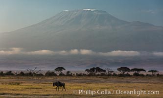
Mount Kilimanjaro, Tanzania, viewed from Amboseli NP, Kenya.
Location: Amboseli National Park, Kenya
Image ID: 29602
Location: Amboseli National Park, Kenya
Image ID: 29602
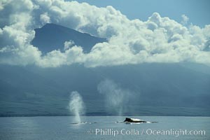
Humpback whales at the surface, volcano and clouds.
Species: Humpback whale, Megaptera novaeangliae
Location: Maui, Hawaii
Image ID: 00425
Species: Humpback whale, Megaptera novaeangliae
Location: Maui, Hawaii
Image ID: 00425
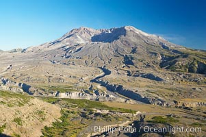
Mount St. Helens viewed from Johnston Observatory five miles away, showing western flank that was devastated during the 1980 eruption.
Location: Mount St. Helens National Volcanic Monument, Washington
Image ID: 13927
Location: Mount St. Helens National Volcanic Monument, Washington
Image ID: 13927
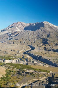
Mount St. Helens viewed from Johnston Observatory five miles away, showing western flank that was devastated during the 1980 eruption.
Location: Mount St. Helens National Volcanic Monument, Washington
Image ID: 13928
Location: Mount St. Helens National Volcanic Monument, Washington
Image ID: 13928
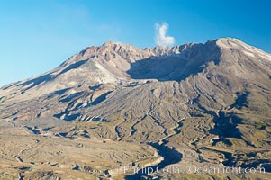
Mount St. Helens viewed from Johnston Observatory five miles away, showing western flank that was devastated during the 1980 eruption.
Location: Mount St. Helens National Volcanic Monument, Washington
Image ID: 13929
Location: Mount St. Helens National Volcanic Monument, Washington
Image ID: 13929
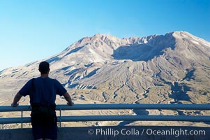
Mount St. Helens viewed from Johnston Observatory five miles away, showing western flank that was devastated during the 1980 eruption.
Location: Mount St. Helens National Volcanic Monument, Washington
Image ID: 13930
Location: Mount St. Helens National Volcanic Monument, Washington
Image ID: 13930
