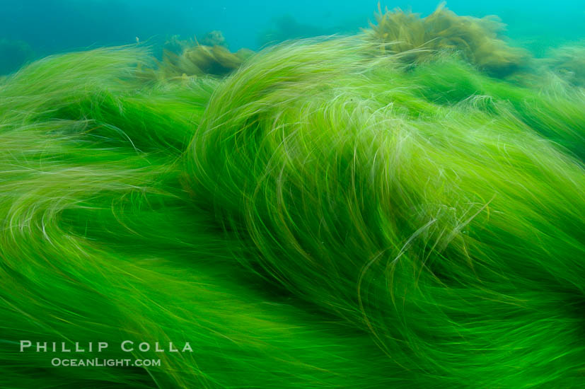
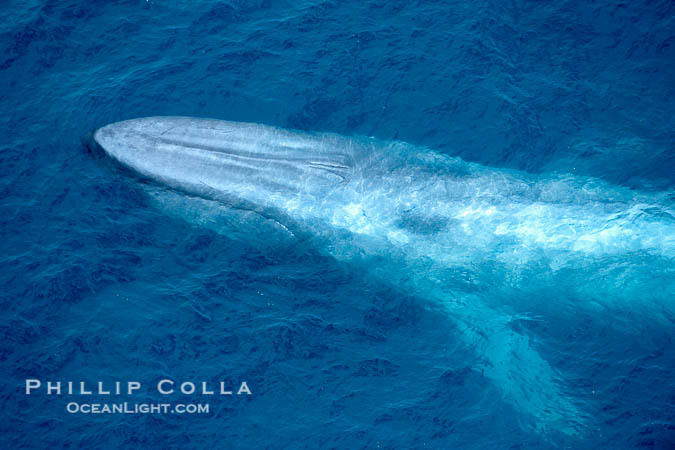
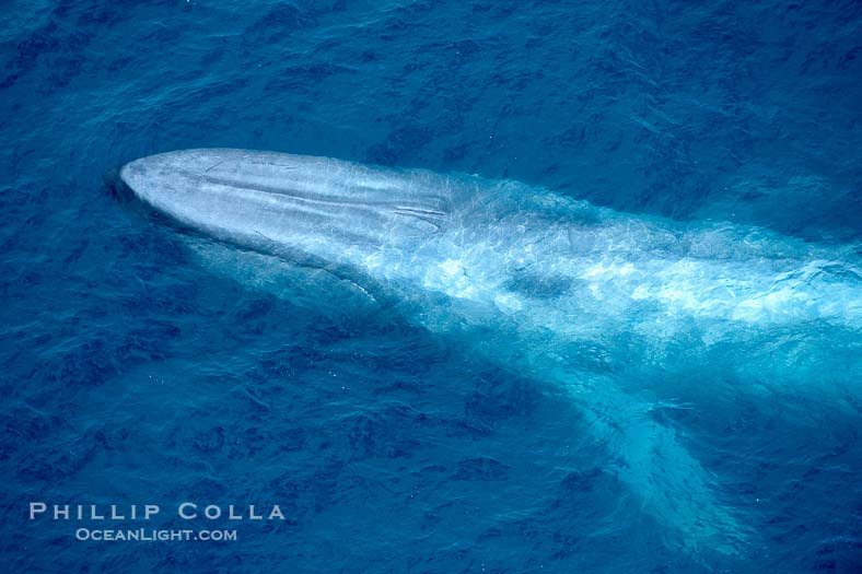
Category

Photography

Abstract

Sunlight in the Ocean, Abstract Photo

Another abstract photo, sunlight piercing the ocean surface. I used to shoot a lot of this stuff when I was diving in the 90's, killing time decompressing at the end of a dive. Note how elegantly the rays of the sun break apart and blend into the water. That is…
April 27, 2009
Abstract

Abstract Photo of the Ocean Surface

I have had good luck selling abstract photos the last few years. I just had another last week. Which got me pondering and ruminating (not a sight for the faint of heart). So without further ado, today begins a series of posts highlighting some of my favorite abstract images. Abstract…
April 25, 2009
Infrared

WTH?

Exciting new initiatives in photography? Pushing the envelope? Outside my comfort zone? Bah, just a load of feel-good jargon nonsense ... Once again, I am not sure what I am doing. See the photos below as evidence. This is about as far removed from underwater film photography (which is where…
April 8, 2009
AlaskaLandscapePanoramas

Kenai Mountains and Kachemak Bay, Alaska

I was up north in Homer, Alaska to photograph bald eagles (Haliaeetus leucocephalus), but I grabbed a couple landscape shots of the beautiful Kenai Mountains, which lie across Kachemak Bay from the Homer Spit. This was my view one morning, after the clouds and snow had cleared out leaving blue…
March 25, 2009
Aerial PhotographyCaliforniaSan Diego

Hotel del Coronado, San Diego

An aerial photo of the Hotel del Coronado, known affectionately as the Hotel Del. It was once the largest hotel in the world, and is one of the country's few remaining wooden Victorian beach resorts. It sits on the beach on Coronado Island, seen here with downtown San Diego in…
February 7, 2009
Aerial PhotographyCaliforniaSan Diego

Crystal Pier, San Diego

Crystal Pier, a combination hotel and pier in the Pacific Beach community of San Diego, extends 872 feet out into the Pacific Ocean. A few dozen cottages sit on the pier near its base. It was built in 1925. Seen beyond Crystal Pier in this aerial photo are Mission Bay…
February 5, 2009
Aerial PhotographyCaliforniaSan Diego

Ocean Beach Pier, San Diego

Here is a view of the Ocean Beach Pier ("OB Pier") with Sunset Cliffs and Point Loma, and even one of the Coronado Islands in the distance. Ocean Beach Pier, also known as the OB Pier or Ocean Beach Municipal Pier, is the longest concrete pier on the West Coast…
February 3, 2009
CanadaPanoramas

Cathedral Grove, Vancouver Island

Vancouver Island is covered with trees (at least those parts that have not been logged out yet). One particularly notable grove is Cathedral Grove, part of MacMillan Provincial Park. In Cathedral Grove enormous Douglas fir and Western hemlock trees are found, not yet taken by the logging industry and recently…
February 2, 2009
Beautiful Views of San DiegoPanoramasSan Diego

Torrey Pines State Beach

A panorama of the view from Flat Rock at sunset, viewed with your back to the sun facing the tall sandstone seacliffs that tower over Torrey Pines State Beach. This was shot from the place where yesterday's Oranjeboom couple was standing. This panoramic photo is a composite of 10 separate…
February 1, 2009
Photography

Marine Mammal Commission 2007 Annual Report to Congress

Each year, the Marine Mammal Commission prepares its annual report to the United States Congress. For the 2007 edition of the report, which is the most recent, all of the photos on the front and back cover are mine. When the report was presented at a special Joint Session of…
January 14, 2009
CaliforniaMorro BayPanoramas

Morro Bay Panorama

I got up early one morning while we were in Morro Bay to photograph the view from Morro Bay State Park, around the bay and north to Morro Rock. There was a slight offshore breeze and the air was cold and dry giving clear views in every direction. My father-in-law's…
January 7, 2009
Best Photographs of the Year

Best Photos of 2008

Best Photos of 2008 In 2008, my photographic pursuits took me (and often, Tracy and the girls as well) all over San Diego, the central coast and deserts of California, Canada, Utah, Arizona, New Mexico, up in a plane and south of the border. Here are the photos from 2008…
December 31, 2008
Aerial PhotographyIslas CoronadoMexico

North Island, Coronado Islands, Mexico

From a recent flight over Islas Coronados (Coronado Islands, Mexico) recently, seen here is the western exposure of North Coronado Island viewed from the southwest. Do you see the crack between the rightmost tip of the island and the main island? There is a narrow submerged passageway through that crack…
September 12, 2008
CaliforniaGeoBlog

Map of Catalina Island Dive Sites and Locations

In the course of geotagging some old photos from Catalina Island, I realized it was simple to display the popular Catalina Island dive locations in Google Earth, Google Maps and Live Search Maps. So here they are. The map below is a small version of the Google Earth display, click…
August 24, 2008
CanadaPanoramas

Big Trees Trail on Meares Island

We had a few hours in Tofino one afternoon. Our choice was to go kayaking or take a boat ride over to Meares Island to walk the Big Trees Trail. We choose the latter. Arriving on the narrow shoreline after a 10-minute skiff ride, our boat driver told us he'd…
July 31, 2008
CanadaGeoBlog

British Columbia Photos on Google Earth

We returned from our British Columbia trip last weekend. We spent time in Whistler, Tofino, Victoria and Vancouver and managed to do a lot of biking, ziplining, hiking, flying, eating and beachcombing. During the past week I've reviewed all the photos we shot and edited down to a selection of…
July 27, 2008
ArizonaPanoramas

Hiking Buckskin Gulch

This is a 360-degree panorama showing, in a single image, a hiker in Buckskin Gulch both coming and going. I set my camera on a tripod in the middle of the trail through Buckskin Gulch, leveled it with a bubble level, and spun it in a complete circle taking sixteen…
June 9, 2008
Galapagos DiariesGeoBlog

Galapagos Islands Photos on Google Earth

Selected images from our collection of Galapagos Island photos can now be browsed in Google Earth. If you have Google Earth installed on your computer, you should be able to click on the link below and have our layer of images open up within Google Earth, showing where in the…
May 17, 2008
Best Photographs of the Year

Best Photos of 2007

Best Photos of 2007 I had a couple of fantastic road trips last year, putting big miles on my Expedition, including a winter trip through Utah and Arizona (where I was able to enjoy a number of iconic locations totally alone!), a long weekend in Minnesota, a memorable journey to…
December 31, 2007
Tear Sheets

Tidelines Calendar 2008

This year's edition of the Tidelines calendar is especially nice because one of our photos appears on the cover (duh). Can you guess where it was shot? Hint: it rhymes with "ledge" and lots of bones are broken there. Order your Tidelines calendar now so you too can time all…
December 4, 2007
Guadalupe IslandMexicoPanoramas

Guadalupe Island Panoramic Photo

I shot this panoramic photo, a series of six individual photographs, one morning last week, shortly after sunrise, from the upper deck of the boat Horizon. Guadalupe Island was covered in that great golden sunrise light that only lasts for a few minutes. The ocean surrounding the island was covered…
September 21, 2007
LandscapeOregonPanoramas

Columbia River Viewed From Vista House

Vista House was built in 1918 as a memorial to Oregon pioneers and as a comfort station for those traveling on the Historic Columbia River Highway. The octagonal stone structure towers 733 feet above the Columbia River and provides a spectacular view. Click it to see it larger, or see…
August 30, 2007
LandscapePanoramasWashington

Photo of North Head Lighthouse, Washington

While in Astoria recently, we took a little drive across to the Washington side of the Columbia River to see North Head Lighthouse. It was overcast, sort of pre-storm looking, perfect weather for walking around a blustery promontory high above the coast and checking out an old lighthouse. Below is…
August 29, 2007
Panoramas

Lunar Eclipse Photo

I took some photos of the total lunar eclipse last night from my backyard. At the peak of the eclipse, when the moon was totally in the Earth's shadow, no direct sunlight reached the moon so it was lit only faintly by light refracting (bending) through the relatively thin layer…
August 28, 2007