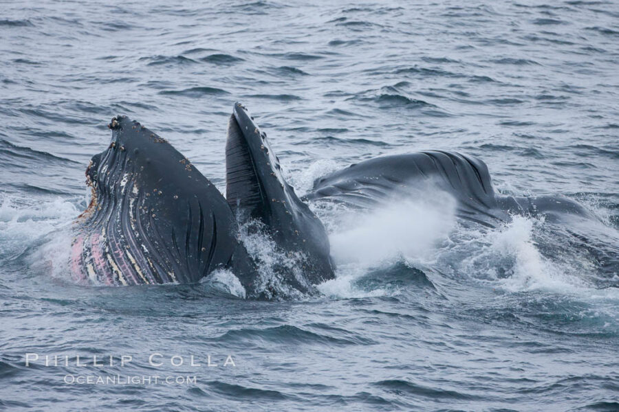
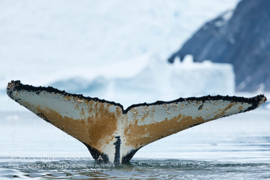
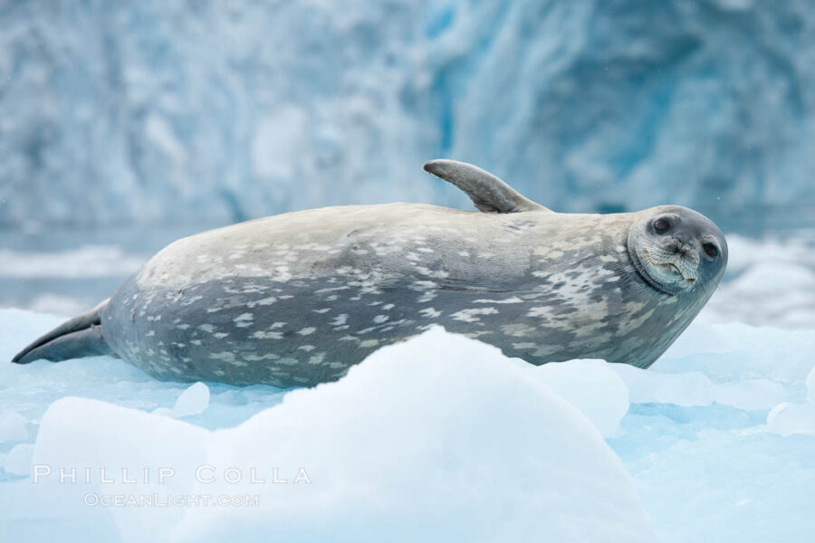
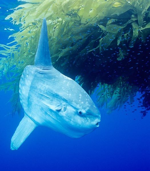
Southern Ocean, Natural History Photography Blog

Stock Photo Gallery: Antarctica Photos

Filed under: Antarctica, Galleries, Southern Ocean on 11/16/2011

Antarctica Pictures and Stock Photos of the Antarctic Peninsula

I have assembled my favorite Antarctica Photos into a stock photography gallery. The Antarctic Peninsula is perhaps the single most photogenic place I have ever been. The photographs nearly take themselves and every direction one turns holds a scenic view. Some of Antarctica holds a stark beauty, while other regions are so chock full of life it is unbelievable. I cannot wait to return to the Southern Ocean and sea Antarctica again.

Click the image below to see a selection of my favorite Antarctica photos. Thanks for looking!

Pack ice, a combination of sea ice and pieces of icebergs, Weddell Sea
Pack ice, a combination of sea ice and pieces of icebergs, Weddell Sea.

Stock Photo Gallery: Icebergs

Filed under: Antarctica, Galleries, Southern Ocean on 8/31/2011

Stock photos of Icebergs

One of my goals in January 2010 when I traveled to the Southern Ocean and Antarctica was to make a series of good iceberg photos. I think I succeeded! It was wonderful cruising around the Antarctic Peninsula and witnessing the variety of shapes, sizes and hues of the thousands of icebergs that we saw there. We also saw impressive icebergs in the South Orkney Islands (Coronation Island) as well as a few around South Georgia Island. Click the image below to see my Gallery of Iceberg Photos. Thanks for looking!

Tabular iceberg, Antarctic Peninsula, near Paulet Island, sunset
Tabular iceberg, Antarctic Peninsula, near Paulet Island, sunset.

Stock Photo Gallery: Penguins!

Stock photography of Penguins

I’m gradually revisiting my website galleries and improving them, removing images of lesser quality (unfortunately a lot of those!) and updating existing galleries with new material. If you enjoy penguins please take a look at my collection of Penguin Photos. With one exception**, all of these penguin photos were taken on a single long trip I made to the Falkland Islands, South Georgia Island and the Antarctic Peninsula (see my lengthy PDF trip journal if you want the deets, or you can view the same info as a series of blog posts). I was thrilled, nearly everyday of my trip to the Southern Ocean, to see penguins in the wild, sometimes in vast numbers, and I cannot wait to return to those places again. Within a few months of returning, one of the images was selected as the cover and inside spread in Nature’s Best, which was a real treat as I had not had an image published in that great magazine in some years. Thanks for looking!

Stock Photos of Penguins
King penguin colony. Over 100,000 pairs of king penguins nest at Salisbury Plain, laying eggs in December and February, then alternating roles between foraging for food and caring for the egg or chick.
 

** The exception is the Galapagos Penguin underwater photo which was made in, you guessed it, the Galapagos Islands in Ecuador.

Surfing Penguins

Filed under: Falklands, Penguin, Southern Ocean on 4/27/2011

Last year I got to cross off one of my bucket list items: surfing penguins. I was fortunate to see surfing gentoo penguins (Pygoscelis papua) on New Island in the Falkland Islands. After hiking around some of New Island for most of the afternoon, visiting a couple of penguin and cormorant rookeries, I found myself at sunset on a gorgeous, long flat sand beach. The light was warm and gold, there was no wind and it was warm enough to wear just a light sweatshirt. All the others on the M/V Polar Star had left to return to the ship and I had the beach to myself, with penguins coming ashore from their foraging excursions in small groups. The gentoo penguins would ride the waves in at top speed, skizzing** across the shallow water and quickly flipping upright to land on their feet. Quickly they would shuffle across the beach and walk up onto the adjacent hills to find their nests and settle in for the evening.

Gentoo penguin coming ashore, after foraging at sea, walking through ocean water as it wades onto a sand beach.  Adult gentoo penguins grow to be 30" and 19lb in size.  They feed on fish and crustaceans.  Gentoo penguins reside in colonies well inland from the ocean, often formed of a circular collection of stones gathered by the penguins, Pygoscelis papua, New Island
Gentoo penguin coming ashore, after foraging at sea, walking through ocean water as it wades onto a sand beach. Adult gentoo penguins grow to be 30″ and 19lb in size. They feed on fish and crustaceans. Gentoo penguins reside in colonies well inland from the ocean, often formed of a circular collection of stones gathered by the penguins.
Image ID: 23830  
Species: Gentoo penguin, Pygoscelis papua
Location: New Island, Falkland Islands, United Kingdom
 

**another invented word, my third this year. Skizzing is like “skimming” only much better.

Standing Around Looking Cool

View This Blog Post in Google Earth (How Cool Is That?)  View this blog entry in Google Earth
Latitude: 63° 34' 21.75" S, Longitude: 55° 46' 17.75" W, Coord: -63.57271°, -55.7716°
Filed under: Antarctica, Penguin, Southern Ocean on 4/13/2011

These Adelie penguins (Pygoscelis adeliae) in Antarctica seem unable to make up their minds which way to go. In fact, they are on a mission, walking from their nests on Paulet Island to the edge of the water, to swim out to sea and forage. I had earlier laid my camera down on the snow alongside the path there were following, and when the penguins strolled up I triggered the camera a few times from 50′ away with a $10 radio trigger I bought on Ebay. The seemed curious about the clicking sound coming from the strange and shiny black box laying on the snow, and stood around looking at it for a while. I made a few fun photos that way, including this one.

A group of Adelie penguins, on packed snow, Pygoscelis adeliae, Paulet Island
A group of Adelie penguins, on packed snow.
Image ID: 25021  
Species: Adelie Penguin, Pygoscelis adeliae
Location: Paulet Island, Antarctic Peninsula, Antarctica
 

Tabular Iceberg Photos

Filed under: Antarctica, Southern Ocean on 3/25/2011

Photos of Tabular Icebergs in Antarctica and the Southern Ocean

Some of the most impressive sights I beheld during my trip along the Antarctic Peninsula were enormous tabular icebergs. Tabular icebergs are sheets of ice, sometimes many miles long, that detach from Antarctica and travel with currents about the Southern Ocean. Tabular icebergs are characteristically flat in appearance, although their sides can be quite sheer and/or serrated. Like all icebergs, about 90% of the mass of a free-floating tabular iceberg is underwater. Tabular icebergs do run aground of course, in which case they can be canted at severe inclinations as they are pounded and broken apart by wave energy and other loose bergs.

Tabular iceberg, Antarctic Peninsula, near Paulet Island, sunset
Tabular iceberg, Antarctic Peninsula, near Paulet Island, sunset.
Image ID: 24778  
Location: Paulet Island, Antarctic Peninsula, Antarctica
 
Tabular iceberg in the Antarctic Sound
Tabular iceberg in the Antarctic Sound.
Image ID: 24783  
Location: Antarctic Sound, Antarctic Peninsula, Antarctica
 
Tabular iceberg in the Antarctic Sound
Tabular iceberg in the Antarctic Sound.
Image ID: 24784  
Location: Antarctic Sound, Antarctic Peninsula, Antarctica
 

Antarctic Fur Seal Photos, Arctocephalus gazella

View This Blog Post in Google Earth (How Cool Is That?)  View this blog entry in Google Earth
Latitude: 54° 0' 36.97" S, Longitude: 37° 41' 40.09" W, Coord: -54.01027°, -37.69447°
Filed under: Fur Seal, South Georgia Island, Southern Ocean on 1/14/2011

Antarctic Fur Seal Photos, Arctocephalus gazella

I love photographing fur seals. (I love diving among them even more, but that is not always possible.) Fur seals are one of the “eared seals”, similar to the gregarious sea lions familiar to my friends on the West Coast. In my opinion, however, fur seals are more elegant and appealing in their behavior and appearance than sea lions. On my trip to South Georgia Island last year, I was looking forward to seeing Antarctic Fur Seals (Arctocephalus gazella). We saw plenty of them. Our timing (early January) coincided with the peak of their presence on the island and with their mating and courtship behavior. At this time, the fur seals are gathered ashore in huge numbers on beaches and rocky shorelines. At some of the landings we considered, the beaches were so crowded with fur seals we could not safely go ashore. During the breeding season, the fur seals’ hormones are raging, which causes adult male fur seals to become quite territorial. The bulls (males) have assembled small harems of females, attempting to mate with each one. The bull fur seals guard access to their females closely, defending the harem against interlopers. For many weeks the bulls remain ashore, guarding their harem, without going to sea for forage for food. They lose weight, and they are often seriously injured in bite-laden conflicts with other males. The fur seal bulls are easily agitated and will take a run at, and even try to nip, a passing human, so it was important for us to keep our eyes on the fur seals and make sure we did not encroach on their space. Even those unfortunate males who were too small or too old to win or maintain a harem were testy, probably as a result of their elevated hormones coupled with no way for them to release that pent up procreative energy. Making my way along a large sand beach near fur seals on the beach was not difficult, but there were times when I was walking through waist-high tussock grass that I would encounter a fur seal unexpectedly. That was exciting. I love these animals.

Antarctic fur seal, Arctocephalus gazella, Hercules Bay
Antarctic fur seal.
Image ID: 24392  
Species: Antarctic Fur Seal, Arctocephalus gazella
Location: Hercules Bay, South Georgia Island
 
Antarctic fur seals, adult male bull and female, illustrating extreme sexual dimorphism common among pinnipeds (seals, sea lions and fur seals), Arctocephalus gazella, Right Whale Bay
Antarctic fur seals, adult male bull and female, illustrating extreme sexual dimorphism common among pinnipeds (seals, sea lions and fur seals).
Image ID: 24324  
Species: Antarctic Fur Seal, Arctocephalus gazella
Location: Right Whale Bay, South Georgia Island
 
An antarctic fur seal pup plays in the water, Arctocephalus gazella, Fortuna Bay
An antarctic fur seal pup plays in the water.
Image ID: 24605  
Species: Antarctic Fur Seal, Arctocephalus gazella
Location: Fortuna Bay, South Georgia Island
 
Leucistic juvenile antarctic fur seal, young pup, juvenile, blond.  A leucistic animal is one that has pigmentation levels far below normal and is thus much more lightly colored, Arctocephalus gazella, Fortuna Bay
Leucistic juvenile antarctic fur seal, young pup, juvenile, blond. A leucistic animal is one that has pigmentation levels far below normal and is thus much more lightly colored.
Image ID: 24617  
Species: Antarctic Fur Seal, Arctocephalus gazella
Location: Fortuna Bay, South Georgia Island
 
Antarctic fur seal colony, on a sand beach alongside Right Whale Bay, with the mountains of South Georgia Island in the background, sunset, Arctocephalus gazella
Antarctic fur seal colony, on a sand beach alongside Right Whale Bay, with the mountains of South Georgia Island in the background, sunset.
Image ID: 24315  
Species: Antarctic Fur Seal, Arctocephalus gazella
Location: Right Whale Bay, South Georgia Island
 
Antarctic fur seal, adult male bull (right) and female (left) confirm their identities via scent, Arctocephalus gazella, Right Whale Bay
Antarctic fur seal, adult male bull (right) and female (left) confirm their identities via scent.
Image ID: 24325  
Species: Antarctic Fur Seal, Arctocephalus gazella
Location: Right Whale Bay, South Georgia Island
 

The Antarctic fur seal (Arctocephalus gazella) is found only in Antarctic waters, with 95% of the world population breeding at South Georgia Island. Male Antarctic fur seals are considerably larger than females, growing to 2m (6.5′) in length and weighing up to 450 lbs. Probably due to the stresses they encounter during the breeding season, males live only about 15 years while females live up to 25 years. Antarctic fur seals breed polygynously, meaning that a single bull (large adult male) mates with up to 20 females in a season. The female groups are often referred to as harems, which the bull guards in a aggressively territorial manner. Breeding territories are established on beaches in October and November. Females give birth to their single pups in November and December. Shortly after (7 to 10 days) they give birth, the females will mate and then sustain a gestation that is about a year long. The pups are weaned after about four months. During the six to eight weeks that they are establishing and maintaining their breeding territories, bull Antarctic fur seals fast and lose up to 3.5 lbs each day. Once the breeding season has ended, the fur seals will leave to spend much of the year at sea, foraging for food. Krill is the most common food source for Antarctic fur seals. Krill stocks around South Georgia Island vary from year to year. Below average amounts of krill stresses the Antarctic fur seal population, which can lead to high mortality, especially among juveniles and pups.

Antarctica Pictures on Photoshelter

Filed under: Antarctica, Photoshelter, Southern Ocean on 1/12/2011

Natural history stock photographs of Antarctica

I have placed a selection of my photos of Antarctica on Photoshelter. Here is a little slideshow:


Antarctica Pictures - Images by Phillip Colla

South Georgia Island Photos on Photoshelter

Filed under: Photoshelter, South Georgia Island, Southern Ocean on 1/10/2011

Natural history stock photographs of South Georgia Island

I have placed a selection of my photos of South Georgia Island on Photoshelter, which makes it easy to offer a slideshow:


South Georgia Island Pictures - Images by Phillip Colla

Photos of the Falkland Islands on Photoshelter

Filed under: Falklands, Photoshelter, Southern Ocean on 1/2/2011

Natural history stock photos of the Falkland Islands (Islas Malvinas)

I have placed a selection of my Falkland Islands photos on my Photoshelter site, which makes it easy to offer a slideshow:


Photos of the Falkland Islands - Images by Phillip Colla

Photography Expedition to Antarctica, South Georgia Island and the Falkland Islands

I’ve finally gathered blog posts and select images into an informal report of my trip to the Antarctic Peninsula, South Georgia Island and the Falkland Islands in January 2010, which is available along with my other articles, reports and downloads. This trip was so much fun, and so rich in wildlife and photography possibilities, that I am already planning two more trips to southern waters to see more. The blog posts from which this article originates are filed under “Southern Ocean“.

A Photography Expedition to Antarctica, South Georgia Island and the Falkland Islands

An informal report and collection of memories and images from my trip to the Antarctic Peninsula, South Georgia Island and the Falkland Islands in January of 2010.
144 pages, 22 mb, PDF.

The Drake Passage, Southern Ocean

Filed under: Southern Ocean on 12/23/2010

The Drake Passage is rumored to be the nastiest, meanest, toughest ocean crossing in the world. Many who round Cape Horn at the southern tip of South America relate the impressiveness of the Drake’s ocean swells. It is a crossing of the Drake, typically a two-day affair during which the Southern Ocean unrelentingly lashes a ship broadside, that affords one a full sense of how much the ocean can dish out. Or at least that is what I hear. In truth we did not experience much distress while crossing the Drake Passage from Antarctica to Tierra del Fuego. I think the swells topped out at about 5-8m (15-24′) on the second day, with a few that probably got up to 10m or so scattered throughout the day. The wind was a steady 25-35 knots, less than the prediction of a few days earlier had forecast. The real telling fact was that most of the passengers were present in the dining room for all three meals rather than in their bunks groaning and retching.

Icebreaker Polar Star, bow plunging through high seas during crossing of the Drake Passage between South America and the Antarctic Peninsula
Icebreaker Polar Star, bow plunging through high seas during crossing of the Drake Passage between South America and the Antarctic Peninsula.
Image ID: 25949  
Location: Drake Passage, Southern Ocean
 

So, in hindsight we were comfortable, moreso than expected, and we did not really have a crossing of which we could boast. I spent some time on the forward observation deck overlooking the bow, trying to photograph green water coming over a bow that was sunk deep into an oncoming swell. In spite of my efforts I managed just two frames that show any significant water over the rail.

As we gradually crawled north toward Ushuaia and our flights home, I thought about those seafarers of a century or two ago, those who braved the Drake Passage in small wooden boats, relying on sextant and grit to find their way, without any real knowledge of how far they had to go to reach “the other side”. Now those were men.

Next: Photography Expedition to Antarctica, South Georgia Island and the Falkland Islands
Previous: Hannah Point, Livingston Island, South Shetland Islands
Trip Index: Cheesemans Antarctica, Falklands and South Georgia
All “Southern Ocean” entries

Hannah Point, Livingston Island, South Shetland Islands

View This Blog Post in Google Earth (How Cool Is That?)  View this blog entry in Google Earth
Latitude: 62° 39' 2.66" S, Longitude: 60° 36' 16.7" W, Coord: -62.65074°, -60.60464°
Filed under: Southern Ocean on 12/22/2010

Our final land visit was at Hannah Point in the South Shetland Islands. The crossing to Livingston Island from the northern tip of the Antarctic peninsula was, in a word, snotty. Decent swells, snow and rain, and high winds. Not drama-queen rough, but rocking and rolling enough that I preferred to sit down with a tea and watch the world go by through the big windows in the upstairs salon than spend my time on deck with a camera. It also meant that the prospects of making a landing were not looking good. But Hannah Point was on the lee side of Livingston Island this morning, and once in the bight of the island (formed by a portion of a volcanic caldera) that makes up the approach to the landing, the seas settled down somewhat and a landing was made. On the point itself are, surprisingly, more penguins. Notably, however, there is also some vegetation, something we saw very little of over the past week in Antartica. A long, curving black-sand beach in the distance showed some juvenile southern elephant seals (Mirounga leonina), so I passed by the penguins and headed down to watch the elephant seals mock-fighting in the water.

Southern elephant seal watches gentoo penguin, Mirounga leonina, Pygoscelis papua, Livingston Island
Southern elephant seal watches gentoo penguin.
Image ID: 25915  
Species: Southern elephant seal, Gentoo penguin, Mirounga leonina, Pygoscelis papua
Location: Livingston Island, Antarctic Peninsula, Antarctica
 
Southern elephant seal, hind flipper detail, Mirounga leonina, Livingston Island
Southern elephant seal, hind flipper detail.
Image ID: 25918  
Species: Southern elephant seal, Mirounga leonina
Location: Livingston Island, Antarctic Peninsula, Antarctica
 

The bulls had by this time of year all cleared off the beach and were out at sea foraging for food. Only younger animals remained, wallowing on a bluff 50’ above the water or down on the sand beach. I tried to make some images of them in the water, wrestling and tossing water about. Occasional blasts of sand-strewn wind would howl down the beach in an effort to bowl us over. Gentoos would regularly swim in to the beach and waddle on the sand to their rookeries a few hundred yards away. Twice I witnessed wind blasts topple the small but sturdy birds, only to see them pop up a moment later and continue on their way as if nothing had happened. I am continually impressed with their hardiness. My final attempt at a photograph on land for this trip was to lay down in the blasting sand, which was growing worse by the hour, and try to illustrate how the sand raked over the seals. I got a few shots that I am reasonably happy with but may be picking sand out of my camera for months. About noon we depart, heading off for what promises to be a fun-filled two days in the Drake Passage.

Southern elephant seal, juveniles mock sparring, Mirounga leonina, Livingston Island
Southern elephant seal, juveniles mock sparring.
Image ID: 25923  
Species: Southern elephant seal, Mirounga leonina
Location: Livingston Island, Antarctic Peninsula, Antarctica
 

Next: The Drake Passage
Previous: Humpback whales in the Gerlache Strait, Antarctica
Trip Index: Cheesemans Antarctica, Falklands and South Georgia
All “Southern Ocean” entries

Humpback Whales in the Gerlache Strait, Antarctica

View This Blog Post in Google Earth (How Cool Is That?)  View this blog entry in Google Earth
Latitude: 64° 50' 27.02" S, Longitude: 62° 36' 1.29" W, Coord: -64.84084°, -62.60036°
Filed under: Antarctica, Humpback Whale, Southern Ocean on 12/21/2010

As we sailed north from Neko Harbor to the South Shetland Islands, we came upon a large assemblage of humpback whales (Megaptera novaeangliae) feeding in the Gerlache Strait. They were on krill, as evidenced by the color of their waste, but the water was too rough to make out patches or balls of the invertebrate stuff. At one point Jim estimated we had seen over 45 humpbacks in the area about 2 miles long by half the width of the strait. One group of five whale provided some excellent examples of surface lunge feeding. While not the coordinated bubble-net feeding that is normally associated with Alaskan humpback whales, the behavior of these whales did include some bubble displays.

Humpback whale lunge feeding on Antarctic krill, with mouth open and baleen visible.  The humbpack's throat grooves are seen as its pleated throat becomes fully distended as the whale fills its mouth with krill and water.  The water will be pushed out, while the baleen strains and retains the small krill, Megaptera novaeangliae, Gerlache Strait
Humpback whale lunge feeding on Antarctic krill, with mouth open and baleen visible. The humbpack’s throat grooves are seen as its pleated throat becomes fully distended as the whale fills its mouth with krill and water. The water will be pushed out, while the baleen strains and retains the small krill.
Image ID: 25648  
Species: Humpback whale, Megaptera novaeangliae
Location: Gerlache Strait, Antarctic Peninsula, Antarctica
 
Humpback whale lunge feeding on Antarctic krill, with mouth open and baleen visible.  The humbpack's pink throat grooves are seen as its pleated throat becomes fully distended as the whale fills its mouth with krill and water.  The water will be pushed out, while the baleen strains and retains the small krill, Megaptera novaeangliae, Gerlache Strait
Humpback whale lunge feeding on Antarctic krill.
Image ID: 25649  
Species: Humpback whale, Megaptera novaeangliae

In fact, it was easy to know when the group of five was about the surface since one of the five predictably produced a subsurface blast of air a few seconds before surfacing. With a little practice it was possible to put the camera near the spot at which the whales would surface and then it was a matter of luck, firing the frames as quickly as possible and hoping the whales would surface with open mouth and full, pleated throat in the frame. We watched the whales until at least 10:30pm, when I finally got a shot of them coming toward the boat. One shot in particular illustrates the baleen, tongue and fully-engorged throat of a krill-feeding humpback. It would have been inconceivable to get this image 10 years ago when I was shooting film, at such a late hour in dim, overcast light, but the modern cameras allow for this sort of photo with relative ease. ISO 1600, lens wide open at f/4, hand-holding a stabilized 500mm lens on a rocking boat at only 1/500, and yet three of the four frames of that sequence are sufficiently sharp for publication. Wonders never cease. About 11pm we finally leave the whales and continue north through the Gerlache Strait, leaving the Antarctic Peninsula in our wake about dawn. Alas, Antarctica is now just a memory.

Scenery in Gerlache Strai.  Clouds, mountains, snow, and ocean, at sunset in the Gerlache Strait, Antarctica
Scenery in Gerlache Strai. Clouds, mountains, snow, and ocean, at sunset in the Gerlache Strait, Antarctica.
Image ID: 25680  
Location: Gerlache Strait, Antarctic Peninsula, Antarctica
 

Next: Hannah Point, Livingston Island, South Shetland Islands
Previous: Neko Harbor, Antarctica
Trip Index: Cheesemans Antarctica, Falklands and South Georgia
All “Southern Ocean” entries

Neko Harbor, Antarctica

View This Blog Post in Google Earth (How Cool Is That?)  View this blog entry in Google Earth
Latitude: 64° 50' 27.02" S, Longitude: 62° 36' 1.29" W, Coord: -64.84084°, -62.60036°
Filed under: Antarctica, Humpback Whale, Southern Ocean on 12/20/2010

Photos of Neko Harbor, Antarctic Peninsula, Antarctica

I awoke this morning to find us in the calm anchorage of Paradise Bay. The water was glass, and bergs were slowly drifting by the boat, riding tidal currents. I set up a time lapse sequence on the stern of the boat and went below for breakfast. An hour later the sequence was finished, and it turned out to be pretty good when viewed in HD. The gentle swing of the boat on its anchor combined nicely with the slow movement of the berg and the passing clouds. Soon after breakfast we motored for about an hour to Neko Harbor, passing a smaller ship (with 250 passengers, crowded!) on our way into Neko Harbor. What a spectacular place. This was one of my favorite spots on the entire peninsula because we finally had a full day of encounters with mammals. (I had had my fill of penguins well before this morning). Light rain and some snow eventually cleared to broken sunshine lighting up the peaks that tower about the ice-filled bay. Two glaciers calved large bergs periodically, including a large snow avalance that blew apart into a cloud of snow late in the afternoon.

A glacier cracks, as the leading edge of the glacier fractures and breaks apart as it reaches the ocean.  The pieces will float away to become icebergs, Neko Harbor
A glacier cracks, as the leading edge of the glacier fractures and breaks apart as it reaches the ocean. The pieces will float away to become icebergs.
Image ID: 25654  
Location: Neko Harbor, Antarctic Peninsula, Antarctica
 

On my morning zodiac outing, Al picked out some good ice for us to inspect, and Patrick took us in for a close look. Huge columns of fractured blue ice defined the leading edge of a glacier. We took a lot of pictures of those formations, and also simply motored by them admiring them. Once back on the big boat for lunch I learned that another group was blessed with an inquisitive minke whale which stayed right next to their zodiac for 90 minutes, spyhopping and circling the 9 lucky viewers. One of the group mentioned to me, in a somewhat reverential tone, that it was a “life moment” for her. I recall some of my earliest, best encounters with whales at close range, and I understand what she must have felt. Good for them. Throughout the day most of the us were fortunate to see scattered crabeater seals (Lobodon carcinophagus), Weddell seals (Leptonychotes weddellii) and leopard seals resting on bergs, along with an occasional minke whale and many good views of humpback whales. I managed to take a few nice photos of humpback whales (Megaptera novaeangliae) fluking up in front of ice, a shot which I had tried for years before in Alaska with no luck. At 4:30pm it was time to wrap it up and head out, too soon to leave Neko Harbor but we had to begin the long sail north through the Gerlach Strait and on to Hannah Point.

Southern humpback whale in Antarctica, with significant diatomaceous growth (brown) on the underside of its fluke, lifting its fluke before diving in Neko Harbor, Antarctica, Megaptera novaeangliae
Southern humpback whale in Antarctica, with significant diatomaceous growth (brown) on the underside of its fluke, lifting its fluke before diving in Neko Harbor, Antarctica.
Image ID: 25647  
Species: Humpback whale, Megaptera novaeangliae
Location: Neko Harbor, Antarctic Peninsula, Antarctica
 
A crabeater seal, hauled out on pack ice to rest.  Crabeater seals reach 2m and 200kg in size, with females being slightly larger than males.  Crabeaters are the most abundant species of seal in the world, with as many as 75 million individuals.  Despite its name, 80% the crabeater seal's diet consists of Antarctic krill.  They have specially adapted teeth to strain the small krill from the water, Lobodon carcinophagus, Neko Harbor
A crabeater seal, hauled out on pack ice to rest. Crabeater seals reach 2m and 200kg in size, with females being slightly larger than males. Crabeaters are the most abundant species of seal in the world, with as many as 75 million individuals. Despite its name, 80% the crabeater seal’s diet consists of Antarctic krill. They have specially adapted teeth to strain the small krill from the water.
Image ID: 25650  
Species: Crabeater seal, Lobodon carcinophagus
Location: Neko Harbor, Antarctic Peninsula, Antarctica
 

Next: Humpback whales in the Gerlache Strait, Antarctica
Previous: Cloudy Morning in Paradise Bay, Antarctica
Trip Index: Cheesemans Antarctica, Falklands and South Georgia
All “Southern Ocean” entries

Cloudy Morning in Paradise Bay, Antarctica

View This Blog Post in Google Earth (How Cool Is That?)  View this blog entry in Google Earth
Latitude: 64° 51' 51.79" S, Longitude: 62° 48' 30.49" W, Coord: -64.864388°, -62.808472°
Filed under: Antarctica, Southern Ocean, Time Lapse, Video on 12/19/2010

Last night we sailed down the Lemaire Channel a second time, after a visit to Peterman Island. This morning we awoke in Paradise Bay. We would remain here for a few hours while we ate breakfast. As I was below in the galley enjoying eggs, cheese, fruit and coffee (the food was great on the M/V Polar Star), I left my camera alone out on the deck shooting one frame every 4 seconds. I slapped them together into a time lapse video, which you see below thanks to Youtube!

Next: Neko Harbor, Antarctica
Previous: Peterman Island, Antarctica
Trip Index: Cheesemans Antarctica, Falklands and South Georgia
All “Southern Ocean” entries

Peterman Island, Antarctica

Filed under: Antarctica, Southern Ocean on 12/18/2010

Photos of Peterman Island, Antarctica

Soon after passing through the Lemaire Channel we arrive at Peterman Island. Peterman Island is a relatively low-lying, somewhat flattish granite island with scattered gentoo penguin (Pygoscelis papua) colonies and some small ponds. Rounded rocks along the edge of the island are awash with small waves, and I make my way to one attractive point away from the penguins (I have had enough of photographing penguins by this point) to make pictures of the water swirling ashore with peaks and clouds in the distance. I stand about thigh deep in the ocean water, but its not as cold as I expected – my boots and pants keep me dry.

Waves rush in, sunset, Antarctica.  Ocean water rushes ashore over the rocky edge of Peterman Island, Antarctica
Waves rush in, sunset, Antarctica. Ocean water rushes ashore over the rocky edge of Peterman Island, Antarctica.
Image ID: 25610  
Location: Peterman Island, Antarctic Peninsula, Antarctica
 

After about 15 minutes, I hear a rustling behind me. A gentoo penguin has snuck up on me, standing on a ledge at my shoulder only about 3’ away, watching me and nosing my backpack lying next to him. We both stand still for a few moments, checking one another out. Is it making sure there is nothing to be fearful of? Perhaps. Eventually, the gentoo starts nibbling some clean white snow next to me. I go on with my picture taking. When I turn around a few minutes later, it is still there watching me, now joined by another gentoo. I set one of my cameras on the granite and put a self timer on it, and let it take a few photos of the two little birds (see next image). Soon they waddle down to the water and swim off.

Gentoo penguins, Peterman Island, Antarctica, Pygoscelis papua
Gentoo penguins, Peterman Island, Antarctica.
Image ID: 25613  
Species: Gentoo penguin, Pygoscelis papua
Location: Peterman Island, Antarctic Peninsula, Antarctica
 

I pack up and hike about the island, past many more penguins on their nests feeding their pairs of chicks:

Gentoo penguin adult tending to its two chicks.  The chicks will remain in the nest for about 30 days after hatching, Pygoscelis papua, Peterman Island
Gentoo penguin adult tending to its two chicks. The chicks will remain in the nest for about 30 days after hatching.
Image ID: 25601  
Species: Gentoo penguin, Pygoscelis papua
Location: Peterman Island, Antarctic Peninsula, Antarctica
 

Before returning by zodiac to the ship, I visit a lonely memorial to three BAS (British Antarctic Survey) scientists who were working at the small research hut on Peterman Island some years ago and trapped there by partially frozen seas with insufficient provisions. The ice conditions were such that the three BAS staff could not safely walk out, nor could a boat reach them. They waited weeks for help. Eventually a BAS ship reached Peterman Island, but instead of finding the researchers only a note was discovered. It is believed all three BAS scientists perished after attempting walk across the thin ice to another research station 9 miles away, likely falling into the strait through the thin ice. The memorial is a poignant reminder of the unforgiving nature of life on the Antarctic Peninsula.

Argentine research hut on Petermann Island, Antarctica, Pygoscelis papua, Peterman Island
Argentine research hut on Petermann Island, Antarctica.
Image ID: 25605  
Species: Gentoo penguin, Pygoscelis papua
Location: Peterman Island, Antarctic Peninsula, Antarctica
 

Next: Cloudy Morning in Paradise Bay, Antarctica
Previous: Lemaire Channel, Antarctica
Trip Index: Cheesemans Antarctica, Falklands and South Georgia
All “Southern Ocean” entries

Lemaire Channel, Antarctica

View This Blog Post in Google Earth (How Cool Is That?)  View this blog entry in Google Earth
Latitude: 65° 3' 27.35" N, Longitude: 63° 55' 42.34" W, Coord: 65.0576°, -63.92843°
Filed under: Antarctica, Southern Ocean on 12/17/2010

Soon after leaving Port Lockroy in our wake, we arrive at the famous Lemaire Channel, noted for its narrow confines and spectacular cliffs rising on each side. About six miles long, the LeMaire Channel takes about one hour to navigate (depending on how much ice is in the channel). Conditions were – surprise! – very cloudy for our passage through the strait. It was nevertheless beautiful, with several sections filled with brash ice and small bergs. We did get a partial sense of the heights and dramatic peaks that rise almost vertically from the edges of the narrow strait but we clearly could not see all the walls and peaks the we knew were hanging above us in the mist. I’ll just have to cross my fingers that it is clear and sunny on my next visit, so I can really appreciate the LeMaire Channel.

Lemaire Channel: mountains, sea, ice and clouds, Antarctica.  The Lemaire Channel, one of the most scenic places on the Antarctic Peninsula, is a strait 11 km long and only 1.6 km wide at its narrowest point
Lemaire Channel: mountains, sea, ice and clouds, Antarctica. The Lemaire Channel, one of the most scenic places on the Antarctic Peninsula, is a strait 11 km long and only 1.6 km wide at its narrowest point.
Image ID: 25602  
Location: Lemaire Channel, Antarctic Peninsula, Antarctica
 
Lemaire Channel: mountains, sea, ice and clouds, Antarctica.  The Lemaire Channel, one of the most scenic places on the Antarctic Peninsula, is a strait 11 km long and only 1.6 km wide at its narrowest point
Lemaire Channel: mountains, sea, ice and clouds, Antarctica. The Lemaire Channel, one of the most scenic places on the Antarctic Peninsula, is a strait 11 km long and only 1.6 km wide at its narrowest point.
Image ID: 25614  
Location: Lemaire Channel, Antarctic Peninsula, Antarctica
 

Next: Peterman Island, Antarctica
Previous: Port Lockroy, Antarctica
Trip Index: Cheesemans Antarctica, Falklands and South Georgia
All “Southern Ocean” entries

Port Lockroy, Antarctica

View This Blog Post in Google Earth (How Cool Is That?)  View this blog entry in Google Earth
Latitude: 64° 49' 38.85" S, Longitude: 63° 29' 26.69" W, Coord: -64.82746°, -63.49075°
Filed under: Antarctica, Southern Ocean on 12/16/2010

Photos of Port Lockroy, Antarctica

It was quite early in the morning that our day began, traveling down the Neumayer Channel to tiny Goudier Island on which the Port Lockeroy base resides. The skies were heavily overcast, so we did not have an opportunity to see the magnificent surroundings that the Neumayer Channel is reputed to offer. (It looks like the weather will remain poor, so our chance to see the Lemaire Channel in all its glory later today is not looking good either.) Port Lockroy is a “living museum”, a former British base, once abandoned but restored in the 90’s by volunteers of the British Antarctic Survey and now tended by four keepers for this season. Port Lockroy offers a look back at what conditions were like for the Brits who manned this small building during World War II. It has never been revealed by the British Government exactly what they were doing on this tiny island during the war, but it is suspected that they were collecting weather data and making foreys through the area looking for enemy naval activity. I bought the girls a few souvenirs at the small gift shop and relaxed watching the penguins on their nests just a few feet from the small buildings that make up Port Lockroy.

Blue whale skeleton in Antarctica, on the shore at Port Lockroy, Antarctica.  This skeleton is composed primarily of blue whale bones, but there are believed to be bones of other baleen whales included in the skeleton as well, Balaenoptera musculus
Blue whale skeleton in Antarctica, on the shore at Port Lockroy, Antarctica. This skeleton is composed primarily of blue whale bones, but there are believed to be bones of other baleen whales included in the skeleton as well.
Image ID: 25604  
Species: Blue whale, Balaenoptera musculus
Location: Port Lockroy, Antarctic Peninsula, Antarctica
 

Nearby is another tiny island — Wiencke Island — that we visit to see an old blue whale skeleton, surrounding by yet more penguin colonies. Actually, the skeleton is made up of bones of a number of whale species, including blue whales. Having seen many blue whales near San Diego from my boat, it was nice to walk about this skeleton and admire how large the bones are, especially the jaw bones which, I believe, are the largest bones in the entire animal kingdom. A few penguins walked idly through the assembled skeleton. Winds blew pretty hard and a little rain fell. This particular landing had more penguin aroma than any other in the past several days, and by the time I am done on Wiencke Island my boots were pretty nasty and needed a real cleaning in the ocean before I was able to hop aboard the zodiac for a ride back to the big boat.

Blue whale skeleton in Antarctica, on the shore at Port Lockroy, Antarctica.  This skeleton is composed primarily of blue whale bones, but there are believed to be bones of other baleen whales included in the skeleton as well, Balaenoptera musculus
Image ID: 25631  

Next: Lemaire Channel, Antarctica
Previous: Cuverville Island, Antarctica
Trip Index: Cheesemans Antarctica, Falklands and South Georgia
All “Southern Ocean” entries

Cuverville Island, Antarctica

View This Blog Post in Google Earth (How Cool Is That?)  View this blog entry in Google Earth
Latitude: 64° 41' 6.57" S, Longitude: 62° 37' 56.17" W, Coord: -64.68516°, -62.63227°
Filed under: Antarctica, Penguin, Southern Ocean on 9/22/2010

Photos of Gentoo Penguins on Cuverville Island, Antarctica

Gentoo penguin tending to its two chicks.  The nest is made of small stones, Pygoscelis papua, Cuverville Island
Gentoo penguin tending to its two chicks. The nest is made of small stones.
Image ID: 25551  
Species: Gentoo penguin, Pygoscelis papua
Location: Cuverville Island, Antarctic Peninsula, Antarctica
 

We are gradually working our way south along the western flanks of the Antarctica Peninsula. This afternoon we reach Cuverville Island after a 60 mile transit through the Gerlache Straight from our morning’s visit to Cierva Cove. Cuverville Island hosts a colony of Gentoo Penguins (Pygoscelis papua) and our timing coincides with the Gentoos’ rearing of their chicks. Gentoo nests are made of small stones, and the adults will frequently (almost constantly) steal stones from one another’s nests. It is a humorous situation to watch but I realize the incessent watchfulness and robbery required of their species’ lifestyle must be tiresome for these small kleptomaniacs. Watching the chicks as they are tended by their parents is the highlight of my time on Cuverville Island. They are so tiny and yet incredibly hardy to survive in such bitterly cold and windy surroundings. A Gentoo penguin chick’s home is literally a small shallow ring of stones built on bare rock, exposed to harsh wind, rain, snow and mist from the nearby ocean, with only the bulk and warmth of its parent penguin to offer any meaningful protection from the elements. Brown skuas are constantly present nearby, awaiting an opportunity to swoop in quickly and attack an unprotected penguin chick. Life is difficult here.

Gentoo penguin colony, Cuverville Island, Pygoscelis papua
Gentoo penguin colony, Cuverville Island.
Image ID: 25533  
Species: Gentoo penguin, Pygoscelis papua
Location: Cuverville Island, Antarctic Peninsula, Antarctica
 

Next: Port Lockroy, Antarctica
Previous: Cierva Cove, Antarctica
Trip Index: Cheesemans Antarctica, Falklands and South Georgia
All “Southern Ocean” entries

Older Posts »

HOME | Online Image Search | Photo of the Day | Contact / Bio | Licensing/Pricing | Prints | Stock List | Image Hierarchy | List of Log Entries | Site Map | Blue Whale | Cetaceans | Pinnipeds | Sharks | Rays | Fishes | Kelp Forest | Sea Birds | Inverts | Man & Animal | Man & Ocean | Ocean & Light | Ocean & Motion | Portraits | About Color and Monitor Calibration | Copyright Statement | All text and photographs copyright © Phillip Colla Natural History Photography   All rights reserved worldwide. The content of this site is made available for purposes of researching images offered for license by Phillip Colla Natural History Photography.  No image is to be copied, duplicated, modified or redistributed in whole or part without the prior written permission of Phillip Colla Natural History Photography.  Whale logo is a trademark of Phillip Colla Natural History Photography, 8021 Paseo Arrayan, Carlsbad, CA 92009, USA.  760.707.7153  Email: oceanlight@OceanLight.com    Web: www.OceanLight.com      Portfolios: www.Gygis.com

Updated: May 25, 2013